| Southill House | |
|---|---|
 | |
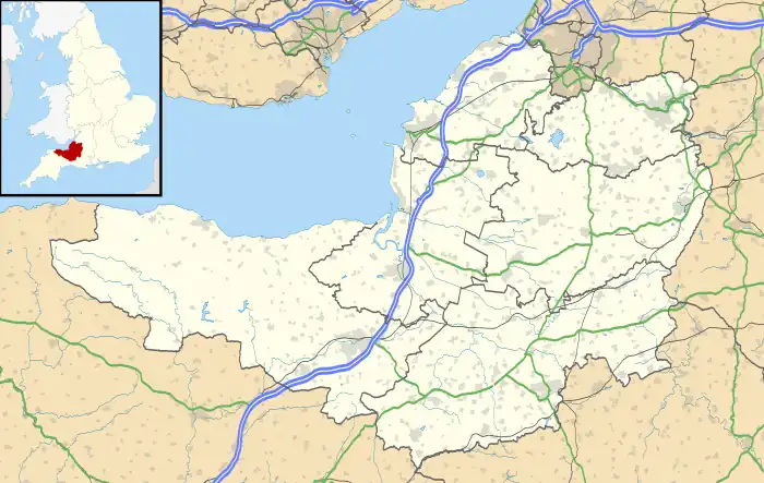
 Location within Somerset | |
| General information | |
| Town or city | Cranmore |
| Country | England |
| Coordinates | 51°10′55″N 2°28′15″W / 51.1819°N 2.4708°W |
| Completed | Early 18th century |
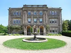
Southill House in Cranmore, Somerset, England, is an early 18th-century manor house. It was given a new facade by John Wood, the Younger, of Bath, in the late 18th century. It has been designated as a Grade I listed building.[1]
The house is on a site which may have been used for Roman buildings including a hypocaust.[2][3]
The current 18th-century building includes some remains from a 17th-century building,.[4] standing in a landscaped park.[5]
in World War II the house was used as a base for the Auxiliary Unit Scout Patrol.[6]
The house received moderate publicity in 1998 when a "cow grazing near the croquet lawn" fell through the turf into a forgotten tunnel. The writings of a Victorian servant in the house, Edwin Charles Cox, revealed that the passages were said to be haunted but upon his exploration only contained remainder furniture.[7]
In 2011 the house was short-listed in a competition run by Country Life magazine to find England's Favourite House and was chosen as the South West regional winner.[8][9][10] The house was owned by the Cotterell family for over 10 years who then eventually sold the house to Stephen Ellis, a London banker.
See also
References
- ↑ "Southill House and outbuildings". historicengland.org.uk. English Heritage. Retrieved 19 May 2009.
- ↑ "Roman building, West Cranmore". Somerset Historic Environment Record. Somerset County Council. Retrieved 24 November 2012.
- ↑ "Roman buildings, Cranmore". Somerset Historic Environment Record. Somerset County Council. Retrieved 24 November 2012.
- ↑ "Southill House and outbuildings, Cranmore". Somerset Historic Environment Record. Somerset County Council. Retrieved 24 November 2012.
- ↑ "Park Southill House, West Cranmore". Somerset Historic Environment Record. Somerset County Council. Retrieved 24 November 2012.
- ↑ Truscoe, Krystyna. "Interim Report for Aerial Survey Component Eastern Mendip Block 1: ST 66 41 to ST 71 46" (PDFaccessdate=24 November 2012). The Aggregate Landscape of Somerset: Predicting the Archaeological Resource. Somerset County Council and English Heritage. p. 35.
- ↑ "Tunnels at Shepton Mallet". News. Frome in Wessex. Retrieved 19 January 2012.
- ↑ "England's Favourite House 2011". Savills. Retrieved 24 November 2012.
- ↑ "England's Favourite House". Telegraph. Archived from the original on 26 June 2014. Retrieved 24 November 2012.
- ↑ "'Remarkable' country home's win". This is Somerset. Retrieved 24 November 2012.