| Spanish Fork Peak | |
|---|---|
 NNW aspect, at sunset in winter | |
| Highest point | |
| Elevation | 10,192 ft (3,107 m)[1][2] |
| Prominence | 2,972 ft (906 m)[3] |
| Parent peak | Strawberry Peak (10,335 ft)[3] |
| Isolation | 8.84 mi (14.23 km)[3] |
| Listing | Highest major summits of the US |
| Coordinates | 40°05′17″N 111°31′40″W / 40.0880375°N 111.5277008°W[4] |
| Naming | |
| Etymology | Spanish Fork (river) |
| Geography | |
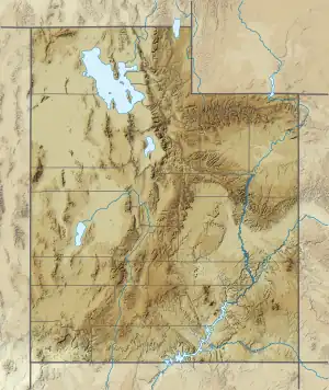
 Spanish Fork Peak Location in Utah  Spanish Fork Peak Spanish Fork Peak (the United States) | |
| Country | United States |
| State | Utah |
| County | Utah County |
| Protected area | Uinta National Forest |
| Parent range | Wasatch Range[1] Rocky Mountains |
| Topo map | USGS Spanish Fork Peak |
| Climbing | |
| Easiest route | class 1 hiking[3] |
Spanish Fork Peak is a 10,192-foot elevation (3,107 m) mountain summit located in Utah County, Utah, United States.
Description
Spanish Fork Peak is set in the Uinta National Forest and is situated in the Wasatch Range which is a subrange of the Rocky Mountains.[1] The city of Spanish Fork lies six miles (9.7 km) to the west and 5,600 feet (1,700 meters) lower than the summit. Precipitation runoff from the mountain's north slope drains to Maple Canyon, whereas the south slope drains to the Spanish Fork River, and all flows to Utah Lake. Topographic relief is significant as the summit rises 5,200 feet (1,600 meters) above the Wasatch Front in 2.5 miles (4.0 km). An ascent of the summit involves hiking 8.5 miles (13.7 km) (round-trip) with 4,870 feet (1,480 meters) of elevation gain via the Sterling Hollow Trail.[5]
History
This mountain's toponym has been officially adopted by the United States Board on Geographic Names.[4] The city and mountain are named after the river. Mapleton residents call the mountain "Maple Mountain" and Maple Mountain High School also refers to this landform.
Climate
According to the Köppen climate classification system, Spanish Fork Peak is located in a dry-summer continental climate zone with cold, snowy winters, and hot, dry summers.[6] Due to its altitude, it receives precipitation as snow in winter and as thunderstorms in summer.
See also
Gallery
References
- 1 2 3 "Spanish Fork Peak, Utah". Peakbagger.com. Retrieved 2023-10-04.
- ↑ Saul Bernard Cohen, The Columbia Gazetteer of the World, Columbia University Press, 2008, p. 3670.
- 1 2 3 4 "Spanish Fork Peak - 10,192' UT". listsofjohn.com. Retrieved 2023-10-04.
- 1 2 "Spanish Fork Peak". Geographic Names Information System. United States Geological Survey, United States Department of the Interior. Retrieved 2023-10-04.
- ↑ Steve Mann (2001), 100 Hikes in Utah, Mountaineers Books, ISBN 9780898867589, p. 85.
- ↑ Peel, M. C.; Finlayson, B. L.; McMahon, T. A. (2007). "Updated world map of the Köppen−Geiger climate classification". Hydrol. Earth Syst. Sci. 11 (5): 1633. Bibcode:2007HESS...11.1633P. doi:10.5194/hess-11-1633-2007. ISSN 1027-5606. S2CID 9654551.
External links
- Spanish Fork Peak: weather forecast
- National Geodetic Survey Data Sheet
- Spanish Fork Peak: US Forest Service


