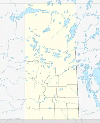
St. Louis | |
|---|---|
Village | |
 St. Louis  St. Louis | |
| Coordinates: 52°55′16″N 105°48′40″W / 52.92111°N 105.81111°W | |
| Country | Canada |
| Province | Saskatchewan |
| Electoral district | Saskatoon–University |
| Census division | 15 |
| Rural municipality | St. Louis |
| Government | |
| • Mayor | Marc Caron |
| • MP | Brad Trost |
| • MLA | Delbert Kirsch |
| Area | |
| • Total | 1.08 km2 (0.42 sq mi) |
| Population (2016) | |
| • Total | 415 |
| • Density | 385.0/km2 (997/sq mi) |
| Time zone | UTC-6 (CST) |
| Postal code | S0J 2C0 |
St. Louis (2016 population: 415) is a village in the Canadian province of Saskatchewan within the Rural Municipality of St. Louis No. 431 and Census Division No. 15. It is south of the City of Prince Albert and northeast of Batoche.
It was founded by Métis settlers in the late 19th century, and is the northernmost Southbranch Settlement, a series of communities which range from Fish Creek in the south along the South Saskatchewan River through Batoche and St. Laurent to St. Louis.
The village is known also for the St. Louis light, a supposed paranormal anomaly.
History
St. Louis incorporated as a village on May 19, 1959.[1]
St. Louis is home to a large archaeological site of Indigenous artifacts predating those found at Wanuskewin near Saskatoon, Saskatchewan.[2] Key discoveries at the site have included new species of wolf and buffalo approximately 25% larger than modern species and a bead that indicates decoration of clothing about 1000 years earlier than previously thought.[3]
St. Louis is just northeast of South Branch House, one of many small trading posts from fur trading days; this post was attacked and burnt by the Atsina in the 18th century, in retaliation for the company's supplying their enemies the Cree and Assiniboine with guns and goods.
Geography
The nearest community of size is Prince Albert, a twenty-seven-minute drive to the north. St. Louis is located near the intersection of Highway 2 north–south and Highway 25; Highway 2 used to run through the village, but now bypasses it several kilometres to the east. The grid road Highway 782 continues westerly along the South Saskatchewan River to arrive at Duck Lake.
Demographics
In the 2021 Census of Population conducted by Statistics Canada, St. Louis had a population of 432 living in 152 of its 154 total private dwellings, a change of 4.1% from its 2016 population of 415. With a land area of 0.97 km2 (0.37 sq mi), it had a population density of 445.4/km2 (1,153.5/sq mi) in 2021.[6]
In the 2016 Census of Population, the Village of St. Louis recorded a population of 415 living in 149 of its 155 total private dwellings, a -8.2% change from its 2011 population of 449. With a land area of 1.08 km2 (0.42 sq mi), it had a population density of 384.3/km2 (995.2/sq mi) in 2016.[7]
Attractions
St. Louis is known also for its St. Louis light, a supposed paranormal anomaly, the historic St. Louis Bridge and the picturesque beauty of the South Saskatchewan River. A large bison sculpture of an extinct species that was 25% larger than modern bison is on display. The sculpture was the last work of Ralph Berg, who created other monumental pieces in Saskatchewan and Manitoba.[8]
Notable people
- Howard Adams (1921–2001), academic and activist
- John B. Boucher (1938–2010), politician
- Maxime Lepine (1837–1897), politician and entrepreneur
- Rich Pilon (born 1968), former ice hockey player
- Joey Tetarenko (born 1978), former ice hockey player
- Louis Schmidt (1844–1935), politician
See also
References
- ↑ "Urban Municipality Incorporations". Saskatchewan Ministry of Government Relations. Archived from the original on October 15, 2014. Retrieved June 1, 2020.
- ↑ The St. Louis archeological find discussed.
- ↑ Press release and additional details regarding the archeological find Archived 2006-01-04 at the Wayback Machine
- ↑ "Saskatchewan Census Population" (PDF). Saskatchewan Bureau of Statistics. Archived from the original (PDF) on September 24, 2015. Retrieved May 31, 2020.
- ↑ "Saskatchewan Census Population". Saskatchewan Bureau of Statistics. Retrieved May 31, 2020.
- ↑ "Population and dwelling counts: Canada, provinces and territories, census divisions and census subdivisions (municipalities), Saskatchewan". Statistics Canada. February 9, 2022. Retrieved April 1, 2022.
- ↑ "Population and dwelling counts, for Canada, provinces and territories, and census subdivisions (municipalities), 2016 and 2011 censuses – 100% data (Saskatchewan)". Statistics Canada. February 8, 2017. Retrieved May 30, 2020.
- ↑ "Works by Ralph Berg (1952–2004)". Retrieved 25 November 2012.
