Suai Airport Commander in Chief of FALINTIL, Kay Rala Xanana Gusmão, International Airport Aeroporto Internacional Comandante-Chefe das FALINTIL, Kay Rala Xanana Gusmão (Portuguese) Aeroportu Internasionál Komandante Xefe FALINTIL, Kay Rala Xanana Gusmão (Tetum) | |||||||||||
|---|---|---|---|---|---|---|---|---|---|---|---|
 | |||||||||||
| Summary | |||||||||||
| Airport type | Public | ||||||||||
| Owner/Operator | Government of East Timor | ||||||||||
| Serves | Suai, Cova Lima, East Timor | ||||||||||
| Location | Labarai, Suai | ||||||||||
| Time zone | TLT (+09:00) | ||||||||||
| Elevation AMSL | 96 ft / 29 m | ||||||||||
| Coordinates | 09°18′14″S 125°17′13″E / 9.30389°S 125.28694°E | ||||||||||
| Map | |||||||||||
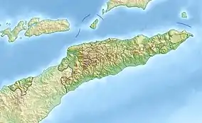
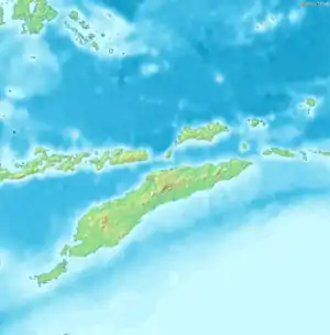
 UAI/WPDB Location of airport in East Timor  UAI/WPDB Location of airport in Timor | |||||||||||
| Runways | |||||||||||
| |||||||||||
Suai Airport (IATA: UAI, ICAO: WPDB), officially Commander in Chief of FALINTIL, Kay Rala Xanana Gusmão, International Airport (Portuguese: Aeroporto Internacional Comandante-Chefe das FALINTIL, Kay Rala Xanana Gusmão, Tetum: Aeroportu Internasionál Komandante Xefe FALINTIL, Kay Rala Xanana Gusmão), and also known as Covalima Airport, is an airport serving Suai, in Cova Lima Municipality, East Timor.[5][6][7][8]
Location
The airport is located 4 km (2.5 mi) east of Suai,[1][2][3] in the southwestern corner of the suco of Labarai, which is part of the Suai administrative post.[9] The airport's runway (16/34) is oriented broadly north-south.[1][4]
History
As of 1974 and 1975, Transportes Aéreos de Timor (TAT), the national airline of the then Portuguese Timor, was operating scheduled domestic services from Dili to Covalima/Suai.[10][11]
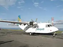
In April 1983, an Indonesian State-owned airline, Merpati Nusantara Airlines, started operating a Kupang–Dili–Maliana–Covalima/Suai flight.[12] In 1985, that service was being flown twice a week.[12] As of the mid 1990s, Merpati was still flying into Covalima/Suai,[13] and in mid 1999, Merpati was operating one flight a week on a Dili–Covalima/Suai–Kupang routing, using an Indonesian-built CASA turboprop aircraft.[14]: 129–130
When the Indonesian occupation of East Timor came to an end later that year, the runway at Suai was still only very short.[14]: 130 During the ensuing INTERFET peacemaking operation, the 17th Construction Squadron of the Australian Army upgraded the airport to support all-weather operations by Lockheed C-130 Hercules aircraft. The runway was extended by 150 metres (490 ft), and a turning node added. Hard stands were provided, along with accommodation, workshops and five helipads.[15]: 101–103
At around that time, the terminal was remodelled and fitted with air conditioning.[16]
In the lead-up to the airport's upgrading in the mid 2010s, its runway was an 'all weather' asphalt strip 1,053 m (3,455 ft) long and 19.3 m (63 ft) wide that could accommodate aircraft as large as a C-130. In general, the airport was for day time use only, but helicopter operations could be supported at night.[16]
East Timor's national Strategic Development Plan 2011-2030 identified a need to extend and refurbish the runway and build new modern facilities.[5]
After a significant upgrading, the airport in its present form was officially inaugurated on 20 June 2017, and named in honour of East Timorese resistance leader and statesman Xanana Gusmão.[5][17][18] The facilities added during the upgrading included a new sealed runway, a terminal building, a control tower, hangars for five large helicopters and fire fighting equipment.[18] The Indonesian State-owned enterprise PT Waskita Karya carried out the upgrading, at a total cost of US$86.7 million.[19]
On 28 September 2018, the airport hosted its first international arrival, a charter flight from Darwin, Australia, operated by Northern Oil & Gas Australia (NOGA).[20]
As of 2019, the airport was barely being used,[21] and usually had no more than one flight a day.[22]
Facilities
As upgraded, the airport has modern facilities complying with the International Civil Aviation Organization (ICAO) standards for the safe operation of airplanes, light aircraft and helicopters. The facilities include a 1,500 m (4,900 ft) runway, a terminal building, a control tower, a fire station, a meteorological station and a helipad with medevac air ambulance capability.[5][17]
See also
References
- 1 2 3 Aeronautical Information Publication (AIP) Archived 2008-08-27 at the Wayback Machine from Timor-Leste Civil Aviation Department Archived 2007-08-04 at the Wayback Machine
- 1 2 "Airport information for WPDB". World Aero Data. Archived from the original on 5 March 2019.
{{cite web}}: CS1 maint: unfit URL (link) Data current as of October 2006. Source: DAFIF. - 1 2 Airport information for UAI at Great Circle Mapper. Source: DAFIF (effective October 2006).
- 1 2 "2.2.3 Timor-Leste Suai National Airport - Logistics Capacity Assessment - Digital Logistics Capacity Assessments". dlca.logcluster.org. World Food Programme. Retrieved 20 February 2022.
- 1 2 3 4 "Inauguration of Suai Airport". Government of Timor-Leste. 21 June 2017. Retrieved 20 February 2022.
- ↑ "Inauguração do Aeroporto do Suai". Government of Timor-Leste (in Portuguese). 21 June 2017. Retrieved 20 February 2022.
- ↑ "Inaugurasaun Aeroportu Suai nian". Government of Timor-Leste (in Tetum). 21 June 2017. Retrieved 20 February 2022.
- ↑ Timor-Leste Tourism Barometer 2018 (PDF) (Report). San Francisco: The Asia Foundation. 2018. pp. 13–14. Retrieved 20 February 2022.
- ↑ Município Covalima: Esboços Mapa Suco no Aldeia Timor-Leste (PDF) (in Tetum). Dili: Ministério das Finanças / Direcção Geral de Estatística / Direcção Nacional Cartografia Estatísticas. 2019. p. 40. Archived from the original (PDF) on 17 November 2020. Retrieved 23 February 2022.
- ↑ Stroud, Michael (21 March 1974). "World airline directory". Flight International. 105 (3393): 1, at 58. Archived from the original on 7 April 2014. Retrieved 13 February 2022.
- ↑ Stroud, Michael (20 March 1975). "World airline directory". Flight International. 108 (3445): 459, at 507. Archived from the original on 2 November 2018. Retrieved 1 November 2018.
- 1 2 "East Timor Now: A Report of the Development Progress". Focus on Indonesia: 13–21, at 16. Winter 1985. Retrieved 16 February 2022.
- ↑ Duapuluh Tahun Timor Timur Membangun = Twenty Years of Development in East Timor (in Indonesian and English). Dili: Korps Pegawai Republik Indonesia Propinsi Timor Timur = Indonesian Civil Servants Corps East Timor Province. February 1996. p. 221. OCLC 68543593.
- 1 2 Pedersen, Jon; Arneberg, Marie (1999). Social and Economic Conditions in East Timor (PDF) (Report). New York: International Conflict Resolution Program School of International and Public Affairs Columbia University / Oslo: Fafo Institute of Applied Social Science. Retrieved 21 June 2022.
- ↑ Tyquin, Michael (2018). Highlands to Deserts. Sydney: Big Sky Publishing. ISBN 978-1-925675-07-8. OCLC 1079394171.
- 1 2 District Profile Covalima (PDF) (Report). April 2002. p. 10. Archived from the original (PDF) on 14 October 2013. Retrieved 26 February 2022.
- 1 2 "South Coast has now an international airport". Government of Timor-Leste. 21 June 2017. Retrieved 21 February 2022.
- 1 2 "VIPs and Medevacs (Timor Leste)". MAF Australia. Retrieved 2 April 2023.
- ↑ "Suai Supply Base". laohamutuk.org.
- ↑ "First international flight at Suai Airport". Government of Timor-Leste. 28 September 2018. Retrieved 21 February 2022.
- ↑ Scott, Jason (29 August 2019). "A $12 Billion Gas Project Could Make or Break This Young Nation". Bloomberg.com. Retrieved 16 June 2022.
- ↑ Barker, Anne; Barnett, Michael (21 July 2019). "Oil and gas is Timor-Leste's ticket to prosperity. Is this impoverished nation blowing its one chance?". ABC News. Retrieved 24 June 2022.
Further reading
- McDonald, Hamish (5 October 2020). "Sun is setting on Timor-Leste's pipe dream". Asia Times. Retrieved 22 February 2022.
- "Goal: Tasi Mane petroleum project Objective: Suai airport rehabilitation Target: G020301 - Suai Airport Rehabilitation". Timor-Leste Government Results Portal. Retrieved 21 February 2022.
- "Suai Supply Base and airport as a part of Tasi Mane Project (TMP), Timor-Leste". Environmental Justice Atlas. Retrieved 21 February 2022.
External links
![]() Media related to Suai Airport at Wikimedia Commons
Media related to Suai Airport at Wikimedia Commons
- Accident history for UAI at Aviation Safety Network
- Foto: Keren, BUMN RI Ini Sulap Bandara di Timor Leste Jadi Megah – article (in Indonesian) with photographs of the airport
