| Sukhaya | |
|---|---|
 | |
| Native name | Сухая (Russian) |
| Location | |
| Country | Russia |
| Region | Murmansk Oblast |
| Physical characteristics | |
| Source | |
| • elevation | 368 m (1,207 ft) |
| Mouth | Iokanga |
• coordinates | 67°43′31″N 38°39′33″E / 67.7253°N 38.6593°E |
• elevation | 174 m (571 ft) |
| Length | 97 km (60 mi) |
| Basin size | 1,340 km2 (520 sq mi) |
| Basin features | |
| Progression | Iokanga→ Barents Sea |
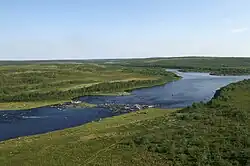
The Sukhaya (Russian: Сухая) is a river in the north of the Kola Peninsula in Murmansk Oblast, Russia. It is 97 kilometres (60 mi) long, and has a drainage basin of 1,340 square kilometres (520 sq mi).[1] The Sukhaya originates on the Keivy and flows into the Iokanga. Its biggest tributary is the Zolotaya.
References
- ↑ "Река Сухая (Выхчйок, Выхча) in the State Water Register of Russia". textual.ru (in Russian).
This article is issued from Wikipedia. The text is licensed under Creative Commons - Attribution - Sharealike. Additional terms may apply for the media files.