| Sutton Bingham Reservoir | |
|---|---|
 | |
 Sutton Bingham Reservoir | |
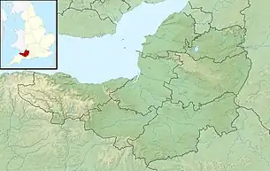
| Location | Sutton Bingham, Closworth, Somerset, England |
| Coordinates | 50°53′54″N 2°38′33″W / 50.89833°N 2.64250°W |
| Built | 1950s[1] |
| Surface area | 142 acres (57 ha)[1] |
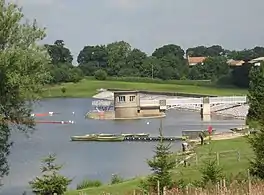
Sutton Bingham Reservoir is a reservoir near the village of Sutton Bingham in the civil parish of Closworth, Somerset, England.
The reservoir was built in the 1950s to supply water to Yeovil.[1][2][3] The remains of Sutton Mill are under the water, and close to the shore is the 12th-century Church of All Saints.[4]
It now provides an environment for overwintering wildfowl and migrant birds including the osprey. It is also used for fishing,[1] and sailing by Sutton Bingham Sailing Club[5] and the Sutton Bingham and District Canoe Club.[6]
References
- 1 2 3 4 "Sutton Bingham reservoir". Wessex Water. Retrieved 19 November 2010.
- ↑ "Remedial works at Sutton Bingham Reservoir" (PDF). British Dams. Retrieved 18 July 2018.
- ↑ "Sutton Bingham Water Treatment Plant". SWECO. Retrieved 18 July 2018.
- ↑ "Stunning South West: Sutton Bingham". Wanderlustin. Retrieved 18 July 2018.
- ↑ "Sutton Bingham Sailing Club". Sutton Bingham Sailing Club. Retrieved 19 November 2010.
- ↑ "Sutton Bingham and District Canoe Club". Sutton Bingham and District Canoe Club. Retrieved 19 November 2010.
External links
 Media related to Sutton Bingham Reservoir at Wikimedia Commons
This article is issued from Wikipedia. The text is licensed under Creative Commons - Attribution - Sharealike. Additional terms may apply for the media files.