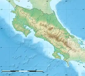
| Térraba-Sierpe Wetland | |
|---|---|
| Humedal Térraba-Sierpe | |
 | |
| Location | Costa Rica |
| Coordinates | 8°54′32″N 83°28′52″W / 8.909°N 83.481°W |
| Area | 267.79 square kilometres (103.39 sq mi) |
| Established | 17 March 1994 |
| Governing body | National System of Conservation Areas (SINAC) |
| Official name | Térraba–Sierpe |
| Designated | 11 December 1995 |
| Reference no. | 782[1] |
Térraba-Sierpe Wetland (Spanish: Humedal Térraba-Sierpe), is a protected area in Costa Rica, managed under the Osa Conservation Area, it was created in 1994 by decree 22993-MIRENEM. [2] [3] It has been designated as a protected Ramsar site since 1995.[1]
References
- 1 2 "Térraba–Sierpe". Ramsar Sites Information Service. Retrieved 7 May 2020.
- ↑ "Humedal Térraba-Sierpe Map". SINAC. Retrieved 6 May 2020.
- ↑ "Humedal Térraba-Sierpe". Protected Planet. Retrieved 6 May 2020.
This article is issued from Wikipedia. The text is licensed under Creative Commons - Attribution - Sharealike. Additional terms may apply for the media files.