Tadiyawan
Tandiyawan | |
|---|---|
Populated place | |
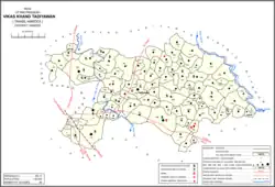 Map showing Tadiyawan (#169) in Tadiyawan CD block | |
| Country | |
| State | Uttar Pradesh |
| District | Hardoi |
| Area | |
| • Total | 5.16 km2 (1.99 sq mi) |
| Population (2011)[1] | |
| • Total | 5,998 |
| • Density | 1,200/km2 (3,000/sq mi) |
| Languages | |
| • Official | Hindi |
| Time zone | UTC+5:30 (IST) |
Tadiyawan, also spelled Tandiyawan, is a village and corresponding community development block in Hardoi district of Uttar Pradesh, India.[1] Located 14 km from the city of Hardoi,[2][3] it hosts a regular market[1] and hosts a Deviji festival on Chaitra Sudi 8 dedicated to worship of the goddess Devi.[4] The village has two primary schools but no healthcare facilities.[1] As of 2011, the population of Tadiyawan is 5,998, in 1,079 households.[1]
Demographic history
The 1961 census recorded Tadiyawan as comprising 4 hamlets, with a total population of 2,078 (1,132 male and 946 female), in 463 households and 378 physical houses.[4] The area of the village was given as 1,371 acres.[4] Average attendance of the Deviji fair was listed as about 600 people at the time.[4]
The 1981 census recorded Tadiyawan as having a population of 2,866, in 563 households, and covering an area of 565.37 hectares.[3]
Villages
Tadiyawan CD block has the following 88 villages:[1]
| Village name | Total land area (hectares) | Population (in 2011) |
|---|---|---|
| Ahrapur | 203.5 | 396 |
| Bargawan | 357 | 2,356 |
| Patkuawan | 451.5 | 2,555 |
| Danialgang | 299.8 | 2,316 |
| Pura Bahadur | 963.1 | 5,594 |
| Jio | 161.8 | 1,302 |
| Nanhey | 562.2 | 3,489 |
| Shivri | 199.3 | 1,550 |
| Lilwal | 591.4 | 3,805 |
| Tari | 159.8 | 841 |
| Odra | 225 | 878 |
| Garhi | 256.9 | 2,051 |
| Japra | 662.3 | 3,633 |
| Harri | 227.4 | 2,190 |
| Sikanderpur | 312.8 | 2,812 |
| Alisa Bad | 371.7 | 2,537 |
| Barauli | 304 | 2,790 |
| Jigniya Khurd | 167.5 | 1,467 |
| Jigniya Kalan | 275.5 | 1,213 |
| Rawal | 332.4 | 2,722 |
| Rawal | 278.3 | 2,285 |
| Ayari | 404.5 | 2,153 |
| Lalpur Bhaisari | 384.8 | 1,988 |
| Mahmadapur | 221 | 2,192 |
| Adampur | 347.3 | 2,744 |
| Sainchamau | 131.9 | 1,026 |
| Purwa Deoriya | 326 | 1,848 |
| Ali Nager | 602.8 | 2,662 |
| Shahpur Mugul | 238.8 | 843 |
| Fukha | 464.2 | 3,227 |
| Teliyani | 123.7 | 758 |
| Hariharpur | 404.3 | 4,103 |
| Nevada | 213 | 1,205 |
| Gauradanda | 429.8 | 2,892 |
| Sainti | 276.9 | 2,238 |
| Tandiyawan (block headquarters) | 516 | 5,998 |
| Kherwa Dalauli | 277.7 | 1,673 |
| Nivuai | 186.4 | 1,936 |
| Dhear Maholiya | 73.4 | 0 |
| Nagheta | 35.5 | 0 |
| Behta Chand | 129.8 | 0 |
| Nanakgang Grant | 369.7 | 1,985 |
| Ramnagar | 140.7 | 0 |
| Bahar | 1,134.3 | 7,922 |
| Asa | 809.3 | 5,734 |
| Murligang | 85.9 | 649 |
| Haripur Grant | 169.8 | 696 |
| Parsani | 257.3 | 876 |
| Sandila | 518.5 | 4,843 |
| Narainpur Grant | 238.7 | 1,283 |
| Pala | 285 | 2,152 |
| Unouti | 280.1 | 2,434 |
| Itoli | 177.8 | 968 |
| Sikrohari | 774.6 | 3,139 |
| Bharayal | 1,211.8 | 6,679 |
| Saripur Chhachheta | 243.1 | 1,445 |
| Dadwani | 252 | 874 |
| Bargadiya | 104 | 525 |
| Kala Aam | 202.4 | 1,582 |
| Kakumau | 517.2 | 2,398 |
| Jagrauli | 355.2 | 1,667 |
| Sardapur | 78.7 | 708 |
| Sakhin | 493.5 | 2,690 |
| Ramuapur | 88 | 688 |
| Bojhwa | 136.1 | 1,121 |
| Sagrapur | 192.9 | 1,744 |
| Thokkhala | 781.2 | 4,108 |
| Bhaunsari | 529.2 | 3,932 |
| Kherwa Mahmoodpur | 55.6 | 0 |
| Gulrhiha | 186.9 | 1,669 |
| Navrangpur | 91.7 | 577 |
| Bharaon | 251.6 | 2,306 |
| Gursanda | 446.1 | 3,786 |
| Sekhora | 907.8 | 2,893 |
| Barra Sarain | 545.2 | 2,212 |
| Masinha | 94.6 | 247 |
| Amethya | 322.7 | 1,678 |
| Sihona | 280.5 | 2,936 |
| Kotra | 694.4 | 3,054 |
| Deviya Fatteypur | 421.8 | 2,326 |
| Karanpur | 289 | 895 |
| Jayrajpur | 625.4 | 3,200 |
| Bhaunta Kamalpur | 300.1 | 1,862 |
| Semrauli | 327.5 | 805 |
| Kuanmau | 86.1 | 228 |
| Baruar | 252.3 | 1,003 |
| Jiginiya | 138.8 | 699 |
| Saadeepur | 117 | 67 |
References
- 1 2 3 4 5 6 7 "Census of India 2011: Uttar Pradesh District Census Handbook - Hardoi, Part A (Village and Town Directory)" (PDF). Census 2011 India. pp. 335–52. Retrieved 10 June 2021.
- ↑ Census 1971 Uttar Pradesh: District Census Handbook Part X-A: Village & Town Directory, District Hardoi (PDF). 1972. pp. 92–3. Retrieved 9 June 2021.
- 1 2 Census 1981 Uttar Pradesh: District Census Handbook Part XIII-A: Village & Town Directory, District Hardoi (PDF). 1982. pp. 128–9. Retrieved 9 June 2021.
- 1 2 3 4 Census 1961: District Census Handbook, Uttar Pradesh (36 - Hardoi District) (PDF). Lucknow. 1965. pp. 158–9, lxiv-lxv of section "Hardoi Tahsil". Retrieved 9 June 2021.
{{cite book}}: CS1 maint: location missing publisher (link)