Tatenberg | |
|---|---|
 The Tatenberg Lock | |
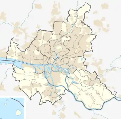
Location of Tatenberg | |
 Tatenberg  Tatenberg | |
| Coordinates: 53°29′0″N 10°5′0″E / 53.48333°N 10.08333°E | |
| Country | Germany |
| State | Hamburg |
| City | Hamburg |
| Borough | Bergedorf |
| Area | |
| • Total | 3.1 km2 (1.2 sq mi) |
| Population (2020-12-31)[1] | |
| • Total | 564 |
| • Density | 180/km2 (470/sq mi) |
| Time zone | UTC+01:00 (CET) |
| • Summer (DST) | UTC+02:00 (CEST) |
| Dialling codes | 040 |
| Vehicle registration | HH |
Tatenberg (ⓘ) is a quarter in Hamburg, Germany, in the borough of Bergedorf. In 2020 the population was 564.
Geography
Tatenberg borders the quarters Spadenland, Ochsenwerder, Moorfleet, Rothenburgsort and Allermöhe. It is located at the Dove Elbe.
Politics
These are the results of Tatenberg in the Hamburg state election:
| State Election | SPD | CDU | Greens | Left | AfD | FDP | Others |
|---|---|---|---|---|---|---|---|
| 2020 | 39,0 % | 21,5 % | 18,4 % | 8,1 % | 4,6 % | 3,4 % | 5,0 % |
| 2015 | 44,1 % | 28,7 % | 7,1 % | 9,2 % | 4,7 % | 2,7 % | 3,5 % |
| 2011 | 36,5 % | 39,4 % | 12,7 % | 5,7 % | – | 2,5 % | 3,2 % |
| 2008 | 23,3 % | 56,7 % | 6,5 % | 6,7 % | – | 3,7 % | 3,3 % |
Tatenberg and Spadenland were the only quarters where the CDU won the majority of the votes in the Hamburg state election in 2011. However the CDU also lost these two quarters in the Hamburg state election in 2015 and the SPD became the most popular party in these quarters as well.
Transport
Tatenberg has no S-Bahn or U-Bahn station but four different bus lines.
References
- ↑ "Bevölkerung in Hamburg am 31.12.2020" (PDF). Statistisches Amt für Hamburg und Schleswig-Holstein. 23 April 2021.
This article is issued from Wikipedia. The text is licensed under Creative Commons - Attribution - Sharealike. Additional terms may apply for the media files.