| Tensleep Formation | |
|---|---|
| Stratigraphic range: Late Pennsylvanian-very Early Permian ~ | |
 | |
| Type | Geological formation |
| Underlies | Phosphoria & Chugwater Formations |
| Overlies | Sacajewea & Amsden Formations |
| Thickness | up to 535 feet (160 m) |
| Lithology | |
| Primary | Sandstone |
| Other | Limestone |
| Location | |
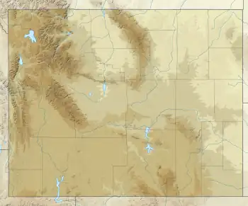
| Coordinates | 42°36′N 108°12′W / 42.6°N 108.2°W |
| Approximate paleocoordinates | 4°18′N 35°12′W / 4.3°N 35.2°W |
| Region | |
| Country | |
| Type section | |
| Named for | Ten Sleep, Wyoming |
| Named by | N.H. Darton[1] |
| Year defined | 1904 |
 Tensleep Sandstone (the United States)  Tensleep Sandstone (Wyoming) | |
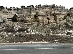
The Tensleep Sandstone is a geological formation of Pennsylvanian to very early Permian age in Wyoming.[2]
The formation is composed of fine- to medium-grained sandstone, light gray and yellowish gray; generally slightly to moderately calcareous; some dolomite and sandy dolomite beds; mostly thick to massive sets of low-angle, wedge-planar crossbeds of dunes. Forms cliffs 61-91m (200-300 feet) thick.[3]
Trace fossils
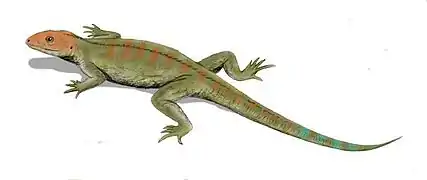
In 1932 Edward Branson and Maurice Mehl reported the discovery of a fossil trackway in the formation.[4] A new ichnospecies, Steganoposaurus belli, was erected for these footprints.[4] The tracks were probably made by a web-footed animal slightly less than three feet long.[4] This creature was originally presumed to be an amphibian, but the toe prints it left behind were pointed like a reptile's rather than round like an amphibians. The actual trackmaker may have been similar to the genus Hylonomus.[5] The ichnogenus Tridentichnus are similar footprints preserved in the Supai Formation of Arizona.[6]
References
- ↑ Darton, N.H., 1904, Comparison of the stratigraphy of the Black Hills, Bighorn Mountains, and Rocky Mountain Front Range: Geological Society of America Bulletin, v. 15, p. 379-448
- ↑ U.S. Geological Survey. "Geologic Unit: Tensleep". Retrieved 2014-12-23.
- ↑ Maughan, E.K. 1972. Geologic map of the Wedding of the Waters Quadrangle, Hot Springs County, Wyoming. US Geological Survey Map GQ-1042
- 1 2 3 "Western Traces in the 'Age of Amphibians'," Lockley and Hunt (1995); page 34.
- ↑ "Western Traces in the 'Age of Amphibians'," Lockley and Hunt (1995); page 35.
- ↑ "Western Traces in the 'Age of Amphibians'," Lockley and Hunt (1995); pages 34-35.
Bibliography
- Lockley, Martin and Hunt, Adrian. Dinosaur Tracks of Western North America. Columbia University Press. 1999.
