| Teplá | |
|---|---|
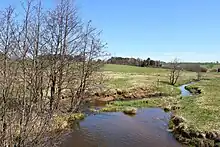
.jpg.webp) The Teplá in Karlovy Vary | |
| Location | |
| Country | Czech Republic |
| Region | Karlovy Vary |
| Physical characteristics | |
| Source | |
| • location | Mariánské Lázně, Teplá Highlands |
| • elevation | 790 m (2,590 ft) |
| Mouth | |
• location | Ohře |
• coordinates | 50°14′3″N 12°52′12″E / 50.23417°N 12.87000°E |
• elevation | 372 m (1,220 ft) |
| Length | 65.1 km (40.5 mi) |
| Basin size | 384.9 km2 (148.6 sq mi) |
| Discharge | |
| • average | 2.73 m3/s (96 cu ft/s) near estuary |
| Basin features | |
| Progression | Ohře→ Elbe→ North Sea |
The Teplá (German: Tepl) is a river in the Czech Republic, a right tributary of the Ohře River. It flows through the Karlovy Vary Region. It is 65.1 km (40.5 mi) long. The basin of the river is known for thermal springs.
Etymology
The name literally means 'warm' and refers to its warm water.[1] In the basin of the river (in the city of Karlovy Vary) there are well-known thermal springs.[2]
Characteristic
The Teplá originates in the territory of Mariánské Lázně in the Teplá Highlands at the elevation of 790 m (2,590 ft) and flows to Karlovy Vary, where it enters the Ohře River at the elevation of 372 m (1,220 ft). It is 65.1 km (40.5 mi) long. Its drainage basin has an area of 384.9 km2 (148.6 sq mi).[2]
The longest tributaries of the Teplá are:
| Tributary | Length (km) | River km | Side |
|---|---|---|---|
| Lomnický potok | 27.7 | 7.5 | right |
| Pramenský potok | 16.5 | 35.2 | left |
Settlements
The river flows through the municipal territories of Mariánské Lázně, Zádub-Závišín, Ovesné Kladruby, Teplá, Nová Ves, Bečov nad Teplou, Teplička, Březová and Karlovy Vary.
Bodies of water
There are 638 bodies of water in the basin area; the largest of them is the Stanovice Reservoir with an area of 110 ha (270 acres). The second largest body of water is Podhora Reservoir with an area of 76 ha (190 acres), built directly on the Teplá.[2] In the lower course of the river is also Březová Reservoir. On the upper course there is a system of several fishponds.
Protection of nature
The almost entire flow of the river is located in the protected landscape area of Slavkov Forest. The area of bogs where the Teplá originates is protected as Prameniště Teplé Nature Reserve with an area of 42.9 ha (106 acres).[3] The valley of the river south of Bečov nad Teplou is protected as Údolí Teplé Nature Reserve with an area of 160.2 ha (396 acres).[4]
Tourism
The sections of the river from Teplá to Bečov nad Teplou and from Bečov nad Teplou to Březová Reservoir are suitable for river tourism, but only in spring or after heavy rains.[5]
Sport
Once a year in September, the Březová Reservoir is drained and paddling races take place under the reservoir.[5]
See also
References
- ↑ Šmilauer, Vladimír. "O původu názvů českých řek". Naše řeč (in Czech). Institute of the Czech Language. Retrieved 2023-10-04.
- 1 2 3 "Základní charakteristiky toku Teplá a jeho povodí" (in Czech). T. G. Masaryk Water Research Institute. Retrieved 2023-10-04.
- ↑ "Prameniště Teplé" (in Czech). Nature Conservation Agency of the Czech Republic. Retrieved 2023-10-04.
- ↑ "Údolí Teplé" (in Czech). Nature Conservation Agency of the Czech Republic. Retrieved 2023-10-04.
- 1 2 "Řeka Teplá na Karlovarsku" (in Czech). CzechTourism. Retrieved 2023-10-04.
External links
- River flow at VD Březová station – Flood Warning and Forecasting Service of the Czech Hydrometeorological Institute