Terrasse-Vaudreuil | |
|---|---|
 | |
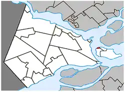
 Location within Vaudreuil-Soulanges RCM | |
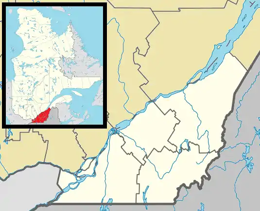
 Terrasse-Vaudreuil Location in southern Quebec | |
| Coordinates: 45°24′N 73°59′W / 45.400°N 73.983°W[1] | |
| Country | Canada |
| Province | Quebec |
| Region | Montérégie |
| RCM | Vaudreuil-Soulanges |
| Constituted | 1 January 1952 |
| Government | |
| • Mayor | Michel Bourdeau |
| • Federal riding | Vaudreuil-Soulanges |
| • Prov. riding | Vaudreuil |
| Area | |
| • Total | 1.20 km2 (0.46 sq mi) |
| • Land | 1.06 km2 (0.41 sq mi) |
| Population (2016)[4] | |
| • Total | 1,986 |
| • Density | 1,865.8/km2 (4,832/sq mi) |
| • Pop 2011-2016 | |
| • Dwellings | 830 |
| Time zone | UTC−5 (EST) |
| • Summer (DST) | UTC−4 (EDT) |
| Postal code(s) | |
| Area code(s) | 514 and 438 |
| Website | www |
Terrasse-Vaudreuil is a small municipality on Île Perrot, just west of Montreal Island in Quebec, Canada. Attractions nearby include Le Faubourg de l'Île, the Terrasse-Vaudreuil baseball field, the soccer field, the municipal pool and POLYMOS, a styrofoam company that operates out of an area where gunpowder was produced during World War II. What started as a small cottage community has now evolved into miniature suburbia. Both entrances and exits of Terrasse-Vaudreuil are blocked by CP/CN train tracks, which has caused frustration in the past to residents. However, Terrasse does enjoy a beach that looks out onto Dorion and the Taschereau Bridge.
History
At the beginning of the 20th century, Terrasse-Vaudreuil was the site of a large powder magazine.[1]
In 1948, its post office opened under the name Terrasse-Vaudreuil, in reference to its location on Lake of Two Mountains and its view towards Vaudreuil Bay and the town of Vaudreuil. In the 1950s, it began to see rapid residential development. The municipality was formed in 1952 when it separated from the Parish Municipality of Notre-Dame-de-l'Île-Perrot. In 1963, the post office closed.[1]
Demographics
| 2016 | 2011 | |
|---|---|---|
| Population | 1,986 (0.8% from 2011) | 1,971 (-0.7% from 2006) |
| Land area | 1.06 km2 (0.41 sq mi) | 1.04 km2 (0.40 sq mi) |
| Population density | 1,865.8/km2 (4,832/sq mi) | 1,903.6/km2 (4,930/sq mi) |
| Median age | 42.6 (M: 41.3, F: 43.6) | 42.6 (M: 41.7, F: 43.4) |
| Private dwellings | 830 (total) | 829 (total) |
| Median household income | $74,624 | $61,777 |
|
| |||||||||||||||||||||||||||||||||
| Source: Statistics Canada[9] | ||||||||||||||||||||||||||||||||||
Language
| Canada Census Mother Tongue - Terrasse-Vaudreuil, Quebec[9] | ||||||||||||||||||
|---|---|---|---|---|---|---|---|---|---|---|---|---|---|---|---|---|---|---|
| Census | Total | French |
English |
French & English |
Other | |||||||||||||
| Year | Responses | Count | Trend | Pop % | Count | Trend | Pop % | Count | Trend | Pop % | Count | Trend | Pop % | |||||
2011 |
1,955 |
1,320 | 67.52% | 440 | 22.51% | 40 | 2.04% | 155 | 7.93% | |||||||||
2006 |
1,980 |
1,355 | 68.43% | 410 | 20.71% | 20 | 1.01% | 195 | 9.85% | |||||||||
2001 |
2,040 |
1,645 | 80.64% | 300 | 14.71% | 20 | 0.98% | 75 | 3.67% | |||||||||
1996 |
1,975 |
1,535 | n/a | 77.72% | 345 | n/a | 17.47% | 35 | n/a | 1.77% | 60 | n/a | 3.04% | |||||
Local government
List of former mayors:
- Donat Bouthillier (1952-1963, 1966-1975)
- Gérard Martin (1963-1966)
- Ronald Bourdeau (1975-1988)
- Paul-Émile Lamarche (1989-1998)
- Bernard Renaud (1998-2005)
- André Reynolds (2005-2009)
- Manon Trudel (2009-2013)
- Michel Bourdeau (2013–present)
Education
Commission Scolaire des Trois-Lacs operates Francophone schools.
- École José-Maria
Lester B. Pearson School Board operates Anglophone schools. It is zoned to Edgewater Elementary School and St. Patrick Elementary School in Pincourt.[10]
See also
References
- 1 2 3 "Banque de noms de lieux du Québec: Reference number 62090". toponymie.gouv.qc.ca (in French). Commission de toponymie du Québec.
- 1 2 Ministère des Affaires municipales, des Régions et de l'Occupation du territoire: Terrasse-Vaudreuil
- ↑ Parliament of Canada Federal Riding History: VAUDREUIL--SOULANGES (Quebec)
- 1 2 "Terrasse-Vaudreuil (Code 2471075) Census Profile". 2016 census. Government of Canada - Statistics Canada.
- ↑ "2016 Community Profiles". 2016 Canadian Census. Statistics Canada. 12 August 2021. Retrieved 9 November 2021.
- ↑ "2011 Community Profiles". 2011 Canadian Census. Statistics Canada. 21 March 2019. Retrieved 2 February 2014.
- ↑ "2006 Community Profiles". 2006 Canadian Census. Statistics Canada. 20 August 2019.
- ↑ "2001 Community Profiles". 2001 Canadian Census. Statistics Canada. 18 July 2021.
- 1 2 1996, 2001, 2006, 2011 census
- ↑ "School Board Map." Lester B. Pearson School Board. Retrieved on 28 September 2017.