| Thoms Run Tributary to Chartiers Creek | |
|---|---|
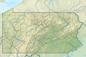 Location of Thoms Run mouth  Thoms Run (Chartiers Creek tributary) (the United States) | |
| Location | |
| Country | United States |
| State | Pennsylvania |
| County | Allegheny |
| Physical characteristics | |
| Source | Robinson Run divide |
| • location | about 0.25 miles north of Beechmont, Pennsylvania |
| • coordinates | 40°23′52″N 080°09′50″W / 40.39778°N 80.16389°W[1] |
| • elevation | 1,110 ft (340 m)[2] |
| Mouth | Chartiers Creek |
• location | Presto, Pennsylvania |
• coordinates | 40°22′19″N 080°07′12″W / 40.37194°N 80.12000°W[1] |
• elevation | 801 ft (244 m)[3] |
| Length | 3.05 mi (4.91 km)[4] |
| Basin size | 12.11 square miles (31.4 km2)[5] |
| Discharge | |
| • location | Chartiers Creek |
| • average | 3.64 cu ft/s (0.103 m3/s) at mouth with Chartiers Creek[5] |
| Basin features | |
| Progression | Chartiers Creek → Ohio River → Mississippi River → Gulf of Mexico[4] |
| River system | Ohio River |
| Tributaries | |
| • left | unnamed tributaries |
| • right | unnamed tributaries |
| Bridges | Nike Site Road, Thomas Run and Oakdale Road, Summerfield Estates Drive, Walnut Lane, Thomas Run and Oakdale Road, Monteverdi Drive, Thoms Run Road, Pinch Road, Bridge Street, Presto-Sygan Road |
Thoms Run is a 3.05 mi (4.91 km) long 2nd order tributary to Chartiers Creek in Allegheny County, Pennsylvania.
Course
Thoms Run rises about 0.25 miles north of Beechmont, Pennsylvania and then flows southeasterly to join Chartiers Creek at Presto.[3]
Watershed
Thoms Run drains 3.45 square miles (8.9 km2) of area, receives about 38.4 in/year of precipitation, has a wetness index of 308.49, and is about 43% forested.[5]
See also
References
- 1 2 "GNIS Detail - Thoms Run". geonames.usgs.gov. US Geological Survey. Retrieved 14 May 2021.
- ↑ "Get Maps". USGS Topoview. US Geological Survey. Retrieved 14 May 2021.
- 1 2 "Get Maps". USGS Topoview. US Geological Survey. Retrieved 14 May 2021.
- 1 2 "ArcGIS Web Application". epa.maps.arcgis.com. US EPA. Retrieved 14 May 2021.
- 1 2 3 "Thoms Run Watershed Report". US EPA Geoviewer. US EPA. Retrieved 14 May 2021.
This article is issued from Wikipedia. The text is licensed under Creative Commons - Attribution - Sharealike. Additional terms may apply for the media files.