Tollette, Arkansas | |
|---|---|
 Location of Tollette in Howard County, Arkansas. | |
| Coordinates: 33°49′9″N 93°53′45″W / 33.81917°N 93.89583°W | |
| Country | United States |
| State | Arkansas |
| County | Howard |
| Area | |
| • Total | 0.96 sq mi (2.49 km2) |
| • Land | 0.96 sq mi (2.49 km2) |
| • Water | 0.00 sq mi (0.00 km2) |
| Elevation | 360 ft (110 m) |
| Population (2020) | |
| • Total | 185 |
| • Density | 192.11/sq mi (74.21/km2) |
| Time zone | UTC-6 (Central (CST)) |
| • Summer (DST) | UTC-5 (CDT) |
| FIPS code | 05-69500 |
| GNIS feature ID | 0058751[2] |
Tollette is a town in southern Howard County, Arkansas, United States. The population was 240 at the 2010 census,[3] down from 324 in 2000.
Geography
Tollette is located in southern Howard County at 33°49′9″N 93°53′45″W / 33.81917°N 93.89583°W (33.819078, -93.895742).[4] Arkansas Highway 355 passes through the town, leading north 4 miles (6 km) to Mineral Springs and south 17 miles (27 km) to Fulton and Interstate 30.
According to the United States Census Bureau, the town has a total area of 0.97 square miles (2.5 km2), all land.[3]
Demographics
| Census | Pop. | Note | %± |
|---|---|---|---|
| 1980 | 407 | — | |
| 1990 | 316 | −22.4% | |
| 2000 | 324 | 2.5% | |
| 2010 | 240 | −25.9% | |
| 2020 | 185 | −22.9% | |
| U.S. Decennial Census[5] | |||
2020 census
| Race | Number | Percentage |
|---|---|---|
| White (non-Hispanic) | 5 | 2.7% |
| Black or African American (non-Hispanic) | 173 | 93.51% |
| Other/Mixed | 4 | 2.16% |
| Hispanic or Latino | 3 | 1.62% |
As of the 2020 United States census, there were 185 people, 108 households, and 72 families residing in the town.
2000 census
As of the census[7] of 2000, there were 324 people, 136 households, and 90 families residing in the town. The population density was 133.1/km2 (343.0/mi2). There were 149 housing units at an average density of 61.2/km2 (157.7/mi2). The racial makeup of the town was 0.62% White, 98.46% Black or African American, and 0.93% from two or more races.
There were 136 households, out of which 24.3% had children under the age of 18 living with them, 33.8% were married couples living together, 29.4% had a female householder with no husband present, and 33.1% were non-families. 31.6% of all households were made up of individuals, and 16.9% had someone living alone who was 65 years of age or older. The average household size was 2.38 and the average family size was 3.01.
In the town, the population was spread out, with 24.1% under the age of 18, 10.5% from 18 to 24, 24.7% from 25 to 44, 22.5% from 45 to 64, and 18.2% who were 65 years of age or older. The median age was 37 years. For every 100 females, there were 90.6 males. For every 100 females age 18 and over, there were 86.4 males.
The median income for a household in the town was $24,688, and the median income for a family was $31,250. Males had a median income of $19,063 versus $18,295 for females. The per capita income for the town was $10,589. About 11.7% of families and 18.5% of the population were below the poverty line, including 17.5% of those under age 18 and 40.0% of those age 65 or over.
Notable person
- Luenell, actress and comedian
References
- ↑ "2020 U.S. Gazetteer Files". United States Census Bureau. Retrieved October 29, 2021.
- 1 2 U.S. Geological Survey Geographic Names Information System: Tollette, Arkansas
- 1 2 "Geographic Identifiers: 2010 Demographic Profile Data (G001): Tollette town, Arkansas". American Factfinder. U.S. Census Bureau. Retrieved April 21, 2017.
- ↑ "US Gazetteer files: 2010, 2000, and 1990". United States Census Bureau. February 12, 2011. Retrieved April 23, 2011.
- ↑ "Census of Population and Housing". Census.gov. Retrieved June 4, 2015.
- ↑ "Explore Census Data". data.census.gov. Retrieved December 30, 2021.
- ↑ "U.S. Census website". United States Census Bureau. Retrieved January 31, 2008.
Municipalities and communities of Howard County, Arkansas, United States | ||
|---|---|---|
| Cities | 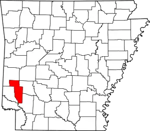 Map of Arkansas highlighting Howard County | |
| Town | ||
| CDPs | ||
| Other unincorporated communities | ||
| Ghost towns | ||
| Footnotes | ‡This populated place also has portions in an adjacent county or counties | |