Torgelow | |
|---|---|
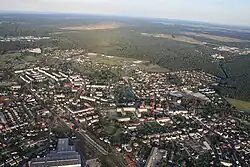
 Aerial view | |
 Flag  Coat of arms | |
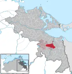
Location of Torgelow within Vorpommern-Greifswald district  | |
 Torgelow  Torgelow | |
| Coordinates: 53°37′N 14°00′E / 53.617°N 14.000°E / 53.617; 14.000 | |
| Country | Germany |
| State | Mecklenburg-Vorpommern |
| District | Vorpommern-Greifswald |
| Municipal assoc. | Torgelow-Ferdinandshof |
| Government | |
| • Mayor | Kerstin Pukallus |
| Area | |
| • Total | 72.22 km2 (27.88 sq mi) |
| Elevation | 10 m (30 ft) |
| Population (2021-12-31)[1] | |
| • Total | 8,929 |
| • Density | 120/km2 (320/sq mi) |
| Time zone | UTC+01:00 (CET) |
| • Summer (DST) | UTC+02:00 (CEST) |
| Postal codes | 17358 |
| Dialling codes | 03976 |
| Vehicle registration | VG |
| Website | www.torgelow.de |
Torgelow (German pronunciation: [ˈtɔʁɡəlo] ⓘ) is a municipality in the Vorpommern-Greifswald district, in Mecklenburg-Western Pomerania in north-eastern Germany. It is situated on the river Uecker, 12 km south of Ueckermünde, and 41 km northwest of Szczecin, Poland. Torgelow was ranked a city on 4 May 1945.
History
From 1648 to 1720, Torgelow was part of Swedish Pomerania. From 1720 to 1945, it was part of the Prussian Province of Pomerania, from 1945 to 1952 of the State of Mecklenburg-Vorpommern, from 1952 to 1990 of the Bezirk Neubrandenburg of East Germany and since 1990 again of Mecklenburg-Vorpommern.
References
- ↑ "Bevölkerungsstand der Kreise, Ämter und Gemeinden 2021" (XLS) (in German). Statistisches Amt Mecklenburg-Vorpommern. 2022.
Geography of Pomerania | |||||
|---|---|---|---|---|---|
| Regions |
| ||||
| Administration | |||||
| Cities and towns |
| ||||
| Inhabited islands | |||||
| Peninsulae and headlands | |||||
| Rivers | |||||
| Lakes | |||||
| Bays, lagoons | |||||
| National parks | |||||
Authority control databases | |
|---|---|
| International | |
| National | |
| Geographic | |
This article is issued from Wikipedia. The text is licensed under Creative Commons - Attribution - Sharealike. Additional terms may apply for the media files.