| Trujillo Formation | |
|---|---|
| Stratigraphic range: Late Triassic, | |
 Trujillo Formation in Texas | |
| Type | Formation |
| Unit of | Dockum Group |
| Overlies | Tecovas Formation |
| Thickness | 45–210 feet (14–64 m) |
| Lithology | |
| Primary | Sandstone |
| Other | conglomerate, mudstone |
| Location | |
| Coordinates | 35°15′00″N 103°01′54″W / 35.2501°N 103.0318°W |
| Region | Texas New Mexico |
| Country | United States |
| Type section | |
| Named for | Trujillo Creek |
| Named by | C.N. Gould |
| Year defined | 1907 |
 Trujillo Formation (the United States)  Trujillo Formation (Texas) | |
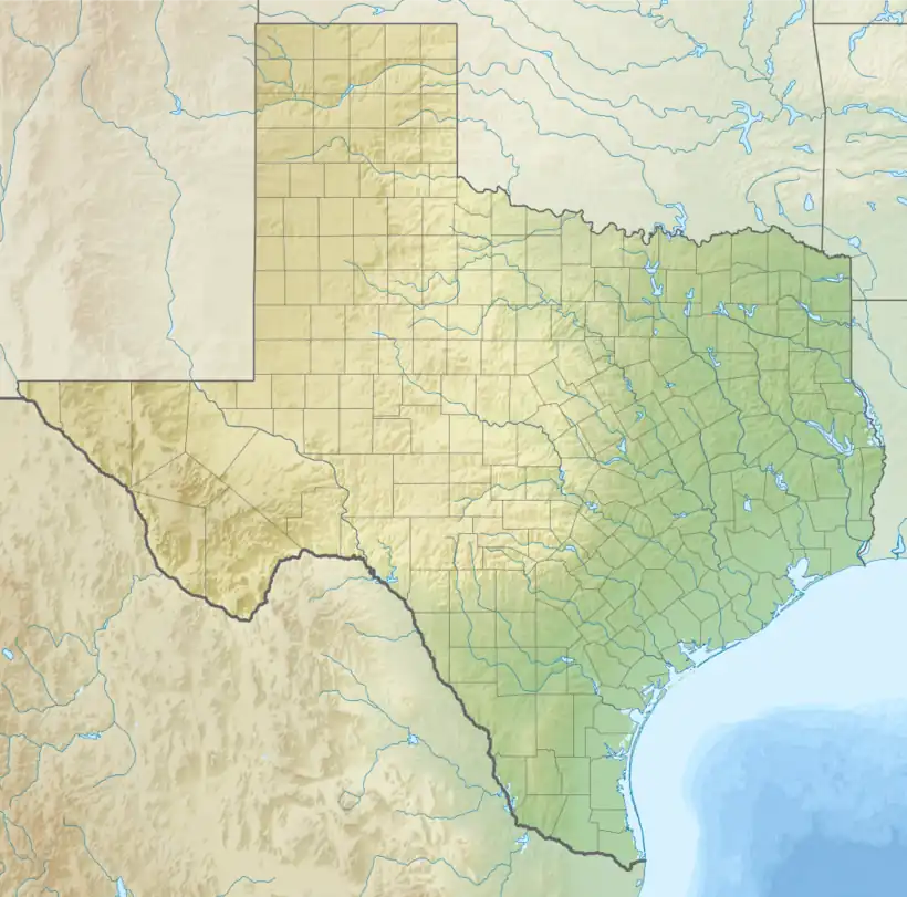
The Trujillo Formation is a geologic formation in Texas[1] and New Mexico.[2] It preserves fossils dating back to the upper Triassic period.[2] It is also known as the Trujillo Sandstone.
Description
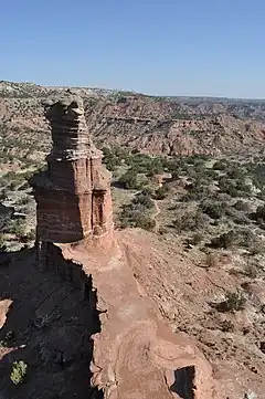
The formation consists mostly of gray to brown or red sandstone, but with some conglomerate and mudstone. Conglomerate is more common in the middle beds while mudstone is more common in the middle and upper beds. The sandstone is typically crossbedded and is fine-grained in the lower beds and more coarse in the middle and upper beds. The lower sandstone beds tend to form a prominent cliff. The total thickness varies from 45–210 feet (14–64 m). The formation overlies the Tecovas Formation.[1]
The Cuervo Sandstone Member is preempted by the Trujillo Formation.[3]
The formation crops out along Palo Duro Canyon and the Canadian River and their tributaries.[1] It is also widespread in the Sangre de Cristo Mountains.[4]
The formation is interpreted as deposition in a braided stream system.[5] The lower beds at Palo Duro Canyon contain unusual cone-shaped iron concretions that likely formed in the vadose zone.[6]
Fossils
The formation contains Typothorax scutes[7] and the unusual cycad Sanmiguelia.[8]
History of investigation
The formation was first named as the upper formation of the Dockum Group in 1907 by C.N. Gould.[1]
See also
References
- 1 2 3 4 Gould, C.N. (1907). "Geology and water resources of the western portion of the Panhandle of Texas". U.S. Geological Survey Water-Supply Paper. 191.
- 1 2 Barnes, V.E. (1983). Geologic atlas of Texas. University of Texas-Austin, Bureau of Economic Geology. p. Tucumcari sheet.
- ↑ Lucas, S.G.; Hunt, A.P. (1989). "Revised Triassic stratigraphy in the Tucumcari basin, east-central New Mexico". Dawn of the age of dinosaurs in the American southwest. New Mexico Museum of Natural History and Science. pp. 150–170. Retrieved 12 November 2021.
- ↑ Lucas, S.G.; Hunt, A.P.; Huber, P. (1990). "Triassic stratigraphy in the Sangre de Cristo Mountains, New Mexico" (PDF). New Mexico Geological Society Field Conference Guidebook. 41: 305–318. Retrieved 17 September 2020.
- ↑ Asquith, George B.; Cramer, Scott L. (September 1975). "Transverse Braid Bars in the Upper Triassic Trujillo Sandstone of the Texas Panhandle". The Journal of Geology. 83 (5): 657–661. doi:10.1086/628148. S2CID 140676202.
- ↑ Dinwiddie, C. L.; Chan, M. A.; McGINNIS, R. N.; Myers, J. L.; Holliday, W. S. (February 2011). "Chronicles of vadose zone diagenesis: cone-shaped iron oxide concretions, Triassic Trujillo Formation, Palo Duro Canyon, Texas: Cone-shaped iron oxide concretions". Geofluids. 11 (1): 87–96. doi:10.1111/j.1468-8123.2010.00321.x.
- ↑ Lucas, Spencer G.; Heckert, Andrew B.; Hunt, Adrian P. (2002). "A new species of the aetosaur Typothorax (Archosauria:Stagonolepididae) from the upper Triassic of east-central New Mexico". New Mexico Museum of Natural History and Science Bulletin. 21. Retrieved 17 September 2020.
- ↑ Ash, Sidney R. (1976). "Occurrence of the Controversial Plant Fossil Sanmiguelia in the Upper Triassic of Texas". Journal of Paleontology. 50 (5): 799–804. JSTOR 1303573.