| Turallin Queensland | |||||||||||||||
|---|---|---|---|---|---|---|---|---|---|---|---|---|---|---|---|
 Turallin | |||||||||||||||
| Coordinates | 27°49′37″S 151°12′26″E / 27.8269°S 151.2072°E | ||||||||||||||
| Population | 64 (SAL 2021)[1] | ||||||||||||||
| Postcode(s) | 4357 | ||||||||||||||
| Area | 108.8 km2 (42.0 sq mi) | ||||||||||||||
| Time zone | AEST (UTC+10:00) | ||||||||||||||
| Location |
| ||||||||||||||
| LGA(s) | Toowoomba Region | ||||||||||||||
| State electorate(s) | Southern Downs | ||||||||||||||
| Federal division(s) | Maranoa | ||||||||||||||
| |||||||||||||||
Turallin is a rural town and locality in the Toowoomba Region, Queensland, Australia.[2][3] In the 2021 census, the locality of Turallin had a population of 64 people.[4]
Geography
The Millmerran–Cecil Plains Road runs along the eastern boundary of the locality.[5]
The land use is predominantly grazing on native vegetation with the remainder being crow growing on both dry and irrigated land.[6]
History
The town takes its name from a village in Ireland.[2][7]
Pine Creek Provisional School opened on 4 September 1888. On 27 July 1904, it was renamed Turallin Provisional School. On 1 January 1909, it became Turallin State School. It closed in 1960.[8] It was at 606 Turallin Road (27°49′44″S 151°12′21″E / 27.8290°S 151.2057°E).[9]
In June 1911, tenders were called to erect an Anglican Church in Turallin.[10] St Luke's Anglican church was dedicated on 20 October 1913 by the Archdeacon of Toowoomba, Arthur Rivers. Its last service was held on 26 July 1953.[11]
In the 2016 census, the locality of Turallin had a population of 65 people.[12]
In the 2021 census, the locality of Turallin had a population of 64 people.[4]
Education
There are no schools in Turallin. The nearest government primary school is Millmerran State School in neighbouring Milmerran to the south-east. The nearest government secondary schools are Millmeran State School (to Year 10) and Pittsworth State High School (to Year 12) in Pittsworth to the east.[6]
References
- ↑ Australian Bureau of Statistics (28 June 2022). "Turallin (suburb and locality)". Australian Census 2021 QuickStats. Retrieved 28 June 2022.
- 1 2 "Turallin – town in Toowoomba Region (entry 35349)". Queensland Place Names. Queensland Government. Retrieved 30 May 2019.
- ↑ "Turallin – locality in Toowoomba Region (entry 48079)". Queensland Place Names. Queensland Government. Retrieved 30 May 2019.
- 1 2 Australian Bureau of Statistics (28 June 2022). "Turallin (SAL)". 2021 Census QuickStats. Retrieved 28 February 2023.
- ↑ Turallin, Queensland (Map). OpenStreetMap. Retrieved 15 March 2022.
- 1 2 "Queensland Globe". State of Queensland. Retrieved 20 July 2023.
- ↑ Milmerran Centennial 25 September 1981
- ↑ Queensland Family History Society (2010), Queensland schools past and present (Version 1.01 ed.), Queensland Family History Society, ISBN 978-1-921171-26-0
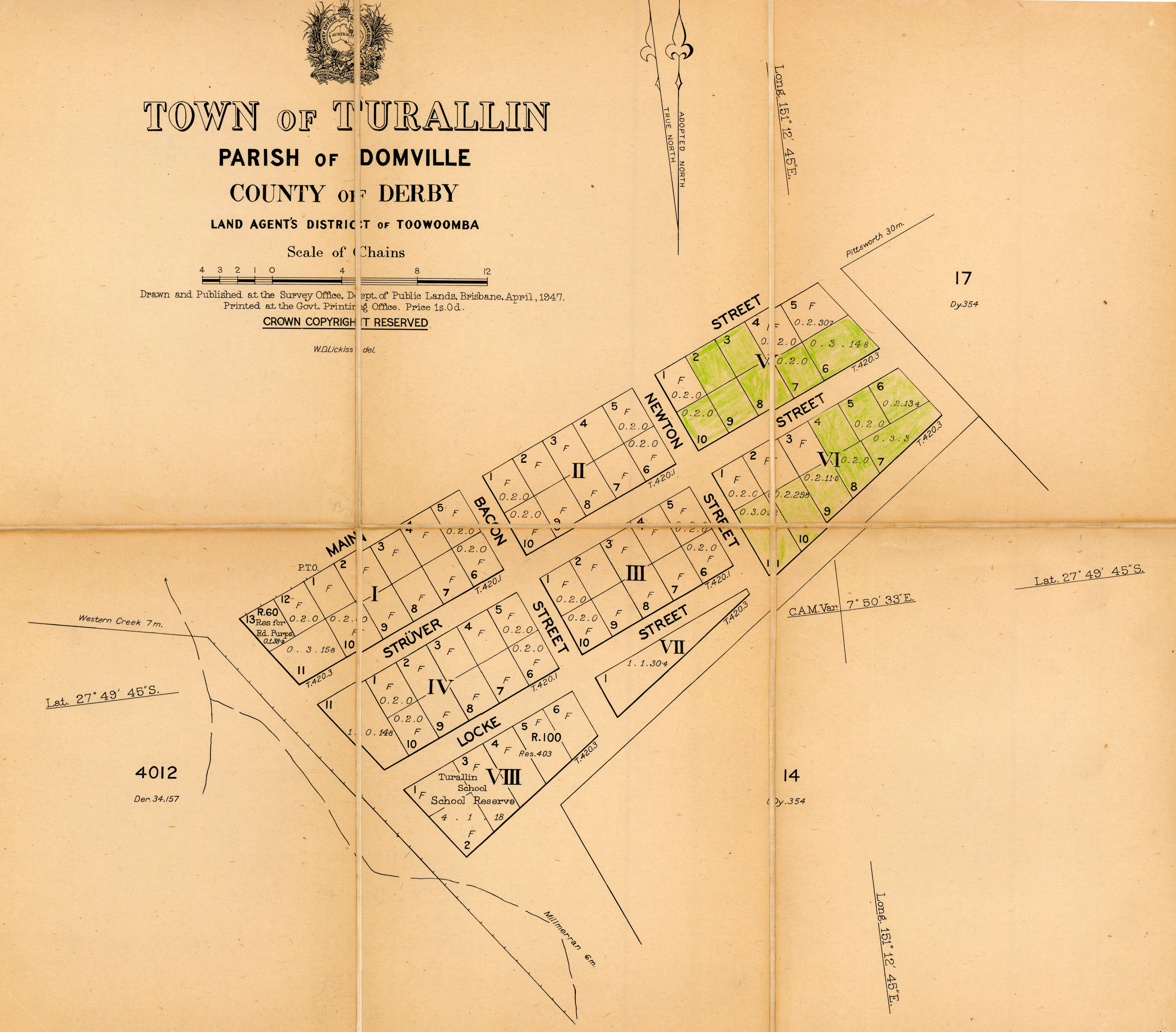
- ↑ "Town of Turallin" (Map). Queensland Government. 1947. Archived from the original on 24 December 2020. Retrieved 24 December 2020.
- ↑ "Advertising". Darling Downs Gazette. Vol. LIII, no. 9, 765. Queensland, Australia. 3 June 1911. p. 1. Archived from the original on 20 July 2023. Retrieved 24 December 2020 – via National Library of Australia.
- ↑ Anglican Church of Southern Queensland. "Closed Churches". Archived from the original on 3 April 2019. Retrieved 3 July 2020.
- ↑ Australian Bureau of Statistics (27 June 2017). "Turallin (SSC)". 2016 Census QuickStats. Retrieved 20 October 2018.
Further reading
- Crompton, Arthur; Schultz, Pauline, Turallin