Uebigau-Wahrenbrück | |
|---|---|
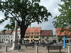 Market square in Uebigau | |
 Coat of arms | |
Location of Uebigau-Wahrenbrück within Elbe-Elster district  | |
 Uebigau-Wahrenbrück 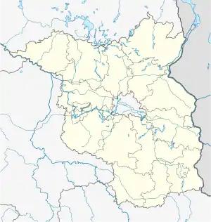 Uebigau-Wahrenbrück | |
| Coordinates: 51°33′N 13°21′E / 51.550°N 13.350°E | |
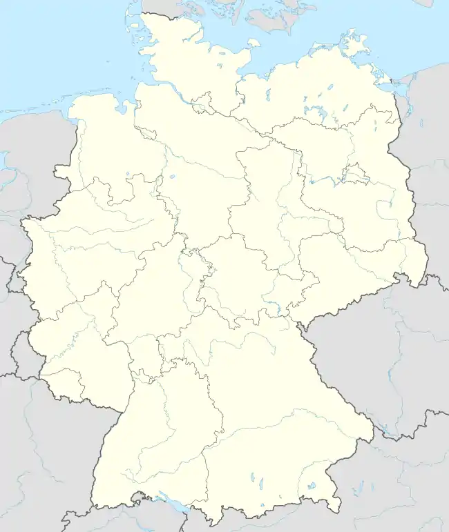
| Country | Germany |
| State | Brandenburg |
| District | Elbe-Elster |
| Municipal assoc. | Liebenwerda |
| Government | |
| • Mayor (2020–25) | Dittgard Hapich[1] |
| Area | |
| • Total | 134.91 km2 (52.09 sq mi) |
| Elevation | 84 m (276 ft) |
| Population (2021-12-31)[2] | |
| • Total | 5,178 |
| • Density | 38/km2 (99/sq mi) |
| Time zone | UTC+01:00 (CET) |
| • Summer (DST) | UTC+02:00 (CEST) |
| Postal codes | 04924, 04938 |
| Dialling codes | 035365 |
| Vehicle registration | EE, FI, LIB |
| Website | www.uebigau-wahrenbrueck.de |
Uebigau-Wahrenbrück is a town in the Elbe-Elster district, in southwestern Brandenburg, Germany. It is situated on the river Schwarze Elster, 11 km northwest of Bad Liebenwerda, and 21 km east of Torgau.
Geography
The town is composed by the villages of Bahnsdorf, Beiersdorf, Beutersitz, Bomsdorf, Bönitz, Domsdorf, Drasdo, Kauxdorf, Langennaundorf, Marxdorf, München/Elster, Neudeck, Prestewitz, Rothstein, Saxdorf, Uebigau (municipal seat), Wahrenbrück, Wiederau, Wildgrube, Winkel and Zinsdorf.
History
From 1815 to 1944, the constituent localities of Uebigau-Wahrenbrück were part of the Prussian Province of Saxony. From 1944 to 1945, they were part of the Province of Halle-Merseburg. From 1952 to 1990, they were part of the Bezirk Cottbus of East Germany. On 31 December 2001, the town of Uebigau-Wahrenbrück was formed by merging the towns of Uebigau and Wahrenbrück with the municipalities of Bahnsdorf, Drasdo and Wiederau.
Demography
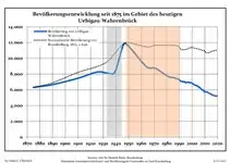 Development of Population since 1875 within the Current Boundaries (Blue Line: Population; Dotted Line: Comparison to Population Development of Brandenburg state; Grey Background: Time of Nazi rule; Red Background: Time of Communist rule)
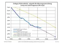 Recent Population Development and Projections (Population Development before Census 2011 (blue line); Recent Population Development according to the Census in Germany in 2011 (blue bordered line); Official projections for 2005-2030 (yellow line); for 2017-2030 (scarlet line)
|
|
|
See also
- Marxdorfer Wolfshund

Notable people
- Johann Gottlieb Graun (1702–1771), a German Baroque/Classical era composer and violinist
- Carl Heinrich Graun (1704–1759), a German composer and tenor.[4]
- Gustav Seyffarth (1796–1885), a German-American Egyptologist
References
- ↑ Landkreis Elbe-Elster Wahl der Bürgermeisterin / des Bürgermeisters, accessed 1 July 2021.
- ↑ "Bevölkerungsentwicklung und Flächen der kreisfreien Städte, Landkreise und Gemeinden im Land Brandenburg 2021" (PDF). Amt für Statistik Berlin-Brandenburg (in German). June 2022.
- ↑ Detailed data sources are to be found in the Wikimedia Commons.Population Projection Brandenburg at Wikimedia Commons
- ↑ . Encyclopædia Britannica. Vol. XI (9th ed.). 1880. p. 64-65.
External links
![]() Media related to Uebigau-Wahrenbrück at Wikimedia Commons
Media related to Uebigau-Wahrenbrück at Wikimedia Commons
Towns and municipalities in Elbe-Elster | ||
|---|---|---|
| Coat of Arms of Elbe-Elster district | |