Uherské Hradiště District
Okres Uherské Hradiště | |
|---|---|
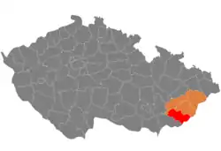 Location in the Zlín Region within the Czech Republic | |
| Coordinates: 49°10′N 17°48′E / 49.167°N 17.800°E | |
| Country | |
| Region | Zlín |
| Capital | Uherské Hradiště |
| Area | |
| • Total | 991.09 km2 (382.66 sq mi) |
| Population (2023)[2] | |
| • Total | 141,496 |
| • Density | 140/km2 (370/sq mi) |
| Time zone | UTC+1 (CET) |
| • Summer (DST) | UTC+2 (CEST) |
| Municipalities | 78 |
| * Towns | 7 |
| * Market towns | 3 |
Uherské Hradiště District (Czech: okres Uherské Hradiště) is a district in the Zlín Region of the Czech Republic. Its capital is the town of Uherské Hradiště.
Administrative division
Uherské Hradiště District is divided into two administrative districts of municipalities with extended competence: Uherské Hradiště and Uherský Brod.
List of municipalities
Towns are marked in bold and market towns in italics:
Babice - Bánov - Bílovice - Bojkovice - Boršice u Blatnice - Boršice - Břestek - Březolupy - Březová - Buchlovice - Bystřice pod Lopeníkem - Částkov - Dolní Němčí - Drslavice - Hluk - Horní Němčí - Hostějov - Hostětín - Hradčovice - Huštěnovice - Jalubí - Jankovice - Kněžpole - Komňa - Korytná - Košíky - Kostelany nad Moravou - Kudlovice - Kunovice - Lopeník - Medlovice - Mistřice - Modrá - Nedachlebice - Nedakonice - Nezdenice - Nivnice - Ořechov - Ostrožská Lhota - Ostrožská Nová Ves - Osvětimany - Pašovice - Pitín - Podolí - Polešovice - Popovice - Prakšice - Rudice - Salaš - Slavkov - Staré Hutě - Staré Město - Starý Hrozenkov - Strání - Stříbrnice - Stupava - Suchá Loz - Šumice - Sušice - Svárov - Topolná - Traplice - Tučapy - Tupesy - Uherské Hradiště - Uherský Brod - Uherský Ostroh - Újezdec - Vápenice - Vážany - Velehrad - Veletiny - Vlčnov - Vyškovec - Záhorovice - Žítková Zlámanec - Zlechov
Geography

Uherské Hradiště District borders Slovakia in the southeast. The terrain is very varied. A lowland runs through the centre of the territory, which is surrounded by highlands and mountains. The territory extends into five geomorphological mesoregions: Vizovice Highlands (most of the territory), White Carpathians (southeast), Lower Morava Valley (a strip from southwest to north), Kyjov Hills (a strip from west to north) and Chřiby (northwest). The highest point of the district is the mountain Velká Javořina in Strání with an elevation of 970 m (3,180 ft). The lowest point of the district is the river bed of the Nová Morava Channel of the Morava River in Uherský Ostroh at 169 m (554 ft).
From the total district area of 991.1 km2 (382.7 sq mi), agricultural land occupies 566.3 km2 (218.6 sq mi), forests occupy 302.7 km2 (116.9 sq mi), and water area occupies 17.3 km2 (6.7 sq mi). Forests cover 30.5% of the district's area.[1]
The main river of the district is the Morava, which flows across the district from north to south. Apart from several artificial lakes, created by the flooding of gravel quarries, and a few oxbow lakes of the Morava River, there are almost no bodies of water.
Bílé Karpaty is a protected landscape area that covers the southeastern part of the district.
Demographics
|
|
| ||||||||||||||||||||||||||||||||||||||||||||||||||||||
| Source: Censuses[3][4] | ||||||||||||||||||||||||||||||||||||||||||||||||||||||||
Most populated municipalities
| Name | Population[2] | Area (km2) |
|---|---|---|
| Uherské Hradiště | 24,812 | 21 |
| Uherský Brod | 16,410 | 52 |
| Staré Město | 6,629 | 21 |
| Kunovice | 5,638 | 29 |
| Bojkovice | 4,365 | 42 |
| Hluk | 4,298 | 28 |
| Uherský Ostroh | 4,278 | 27 |
| Ostrožská Nová Ves | 3,424 | 26 |
| Nivnice | 3,384 | 25 |
| Strání | 3,355 | 40 |
Economy
The largest employers with headquarters in Uherské Hradiště District and at least 500 employees are:[5]
| Economic entity | Location | Number of employees | Main activity |
|---|---|---|---|
| Uherské Hradiště Hospital | Uherské Hradiště | 1,500–1,999 | Health care |
| Česká zbrojovka | Uherský Brod | 1,500–1,999 | Manufacture of firearms |
| Aircraft Industries | Kunovice | 500–999 | Manufacture of airplanes |
| Hamé | Kunovice | 500–999 | Food industry |
| Sociální služby Uherské Hradiště | Uherské Hradiště | 500–999 | Social work |
| Slovácké strojírny | Uherský Brod | 500–999 | Manufacture of lifting and handling equipment |
| Eurotec | Uherský Ostroh | 500–999 | Automotive industry |
| Jednota spotřební družstvo v Uherském Ostrohu | Uherský Ostroh | 500–999 | Retail sale |
Transport
There are no motorways passing through the district. The most important road is the I/50 (part of the European route E50) from Brno to Trenčín.
Sights
_2.jpg.webp)
The most important monuments in the district, protected as national cultural monuments, are:[6]
- A set of monuments of the Great Moravian residential agglomeration in Staré Město – Uherské Hradiště – Modrá
- Gord of Saint Clement in Osvětimany
- Buchlov Castle
- Buchlovice Castle
- Basilica of the Assumption of the Virgin Mary and Saints Cyril and Methodius in Velehrad
The best-preserved settlements, protected as monument reservations and monument zones, are:[7]
- Veletiny-Stará Hora (monument reservation)
- Vlčnov-Kojiny (monument reservation)
- Uherské Hradiště
- Uherský Brod
- Uherský Ostroh
Six of the ten most visited tourist destinations of the Zlín Region are located in Uherské Hradiště District. The most visited tourist destinations are the basilica in Velehrad, Uherské Hradiště Aquapark, Živá voda in Modrá, Kovozoo in Staré Město, Modrá Archeoskanzen, and Buchlovice Castle.[8]
Notable people
References
- 1 2 "Land use (as at 31 December)". Public database. Czech Statistical Office. Retrieved 2023-05-19.
- 1 2 "Population of Municipalities – 1 January 2023". Czech Statistical Office. 2023-05-23.
- ↑ "Historický lexikon obcí České republiky 1869–2011 – Okres Uherské Hradiště" (in Czech). Czech Statistical Office. 2015-12-21. pp. 1–2.
- ↑ "Population Census 2021: Population by sex". Public Database. Czech Statistical Office. 2021-03-27.
- ↑ "Registr ekonomických subjektů". Business Register (in Czech). Czech Statistical Office. Retrieved 2023-04-06.
- ↑ "Výsledky vyhledávání: Národní kulturní památky, okres Uherské Hradiště". Ústřední seznam kulturních památek (in Czech). National Heritage Institute. Retrieved 2023-04-10.
- ↑ "Výsledky vyhledávání: Památkové rezervace, Památkové zóny, okres Uherské Hradiště". Ústřední seznam kulturních památek (in Czech). National Heritage Institute. Retrieved 2023-04-10.
- ↑ "Turisté mají v České republice nejraději zoologické zahrady, technické památky, koupání a Pražský hrad" (in Czech). CzechTourism. 2022-06-24. Retrieved 2023-04-10.
External links
- Uherské Hradiště District – profile on the Czech Statistical Office website