Union Township | |
|---|---|
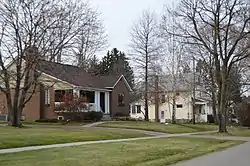
 Houses in Oakwood | |
 Location of Union Township in Lawrence County | |
 Location of Lawrence County in Pennsylvania | |
| Country | United States |
| State | Pennsylvania |
| County | Lawrence |
| Established | 1798 |
| Area | |
| • Total | 9.62 sq mi (24.90 km2) |
| • Land | 9.52 sq mi (24.65 km2) |
| • Water | 0.10 sq mi (0.25 km2) |
| Highest elevation [2] (west of US 422) | 1,166 ft (355 m) |
| Lowest elevation [2] (Mahoning River) | 778 ft (237 m) |
| Population | |
| • Total | 4,991 |
| • Estimate (2022)[3] | 4,906 |
| • Density | 522.33/sq mi (201.68/km2) |
| Time zone | UTC-4 (EST) |
| • Summer (DST) | UTC-5 (EDT) |
| Area code | 724 |
| Website | uniontownshiplawrencecounty |
| Census | Pop. | Note | %± |
|---|---|---|---|
| 2000 | 5,103 | — | |
| 2010 | 5,190 | 1.7% | |
| 2020 | 4,997 | −3.7% | |
| 2022 (est.) | 4,906 | [3] | −1.8% |
| U.S. Decennial Census[4] | |||
Union Township is a township in Lawrence County, Pennsylvania, United States. The population was 4,997 at the time of the 2020 census,[5] a decline from the figure of 5,190 as of 2010.[6]
Geography
According to the United States Census Bureau, the township has a total area of 9.7 square miles (25.0 km2), of which 9.6 square miles (24.9 km2) is land and 0.04 square miles (0.1 km2), or 0.41%, is water.
Unincorporated communities in the township include Harbor, Harbor Bridge, Parkstown, Belmar Park, Westview Heights, Oakwood, and Oakland.
Demographics
As of the census[7] of 2000, there were 5,103 people, 2,121 households, and 1,495 families residing in the township.
The population density was 530.3 inhabitants per square mile (204.7/km2). There were 2,227 housing units at an average density of 231.4 per square mile (89.3/km2).
The racial makeup of the township was 94.92% White, 4.06% African American, 0.02% Native American, 0.16% Asian, 0.29% from other races, and 0.55% from two or more races. Hispanic or Latino of any race were 0.53% of the population.
There were 2,121 households, out of which 23.3% had children under the age of eighteen living with them; 55.2% were married couples living together, 11.2% had a female householder with no husband present, and 29.5% were non-families. 26.3% of all households were made up of individuals, and 15.1% had someone living alone who was sixty-five years of age or older.
The average household size was 2.40 and the average family size was 2.89.
In the township the population was spread out, with 18.9% under the age of eighteen, 6.9% from eighteen to twenty-four, 24.3% from twenty-five to forty-four, 26.5% from forty-five to sixty-four, and 23.5% who were sixty-five years of age or older. The median age was forty-five years.
For every one hundred females there were 91.4 males. For every one hundred females who were aged eighteen or older, there were 89.0 males.
The median income for a household in the township was $36,074, and the median income for a family was $41,909. Males had a median income of $32,297 compared with that of $21,378 for females.
The per capita income for the township was $16,717.
Roughly 3.9% of families and 5.6% of the population were living below the poverty line, including 5.6% of those who were under the age of eighteen and 4.7% of those who were aged sixty-five or older.
References
- ↑ "2016 U.S. Gazetteer Files". United States Census Bureau. Retrieved Aug 14, 2017.
- 1 2 "Turkey Hill Topo Map, Lawrence County PA (New Castle South Area)". TopoZone. Locality, LLC. Retrieved 5 September 2019.
- 1 2 3 Bureau, US Census. "City and Town Population Totals: 2020-2022". Census.gov. US Census Bureau. Retrieved June 13, 2023.
- ↑ "Census of Population and Housing". Census.gov. Retrieved June 4, 2016.
- ↑ Bureau, US Census. "City and Town Population Totals: 2020-2021". Census.gov. US Census Bureau. Retrieved 26 June 2022.
- ↑ "Profile of General Population and Housing Characteristics: 2010 Demographic Profile Data (DP-1): Union township, Lawrence County, Pennsylvania". United States Census Bureau. Retrieved March 28, 2012.
- ↑ "U.S. Census website". United States Census Bureau. Retrieved 2008-01-31.
