| Upper Boddington | |
|---|---|
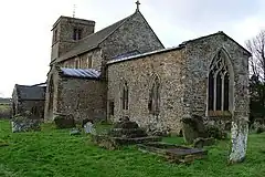
 St. John the Baptist | |
.svg.png.webp) Upper Boddington Location within Northamptonshire | |
| Civil parish | |
| Unitary authority | |
| Ceremonial county | |
| Region | |
| Country | England |
| Sovereign state | United Kingdom |
| Post town | DAVENTRY |
| Postcode district | NN11 |
| Dialling code | 01327 |
| Police | Northamptonshire |
| Fire | Northamptonshire |
| Ambulance | East Midlands |
| UK Parliament |
|
Upper Boddington is a village and former civil parish, now in the parish of Boddington, in the West Northamptonshire district, in the ceremonial county of Northamptonshire, England. In 1931 the parish had a population of 198.[1] On 1 April 1935 the parish was abolished and merged with Lower Boddington to form "Boddington".[2]
The village is located approximately 10 miles from Daventry, 12 miles from Banbury and 16 miles from Leamington Spa. Its far enough away from urban areas to maintain a rural village character, but close enough so that commuters have easy access to the M1 and M40 motorways .
The village's name means 'hill of Bota'.[3]
The village has a number of community facilities and businesses that serve the local area: the Church of England Primary School, post office, the Plough Inn pub, a newly constructed village hall situated next to the playing fields, and Upper Boddington church. Upper Boddington is also home to successful motor racing team, Team GCR which in 2009 fielded a car in the FIA European GT4 Championship.
Local activities range from darts and skittles leagues at the Plough Inn, badminton matches and yoga classes at the village hall, a six-a-side football team playing in Napton and a classic car get-together every first Sunday of the month at the Village Garage. There is also a brand new cycle park in the village park.
References
- ↑ "Population statistics Upper Boddington PA/CP through time". A Vision of Britain through Time. Retrieved 4 May 2023.
- ↑ "Relationships and changes Upper Boddington PA/CP through time". A Vision of Britain through Time. Retrieved 4 May 2023.
- ↑ "Key to English Place-names".