Verdens Ende
Helgerødtangen | |
|---|---|
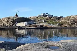
 Verdens Ende has a reconstructed tipping lantern, a port, and the visitors' centre for Færder National Park Credit: Karl Ragnar Gjertsen, 2017 | |
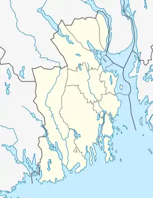
 Verdens Ende Location of the peninsula  Verdens Ende Verdens Ende (Norway) | |
| Coordinates: 59°03′30″N 10°24′26″E / 59.05832°N 10.40709°E | |
| Location | Vestfold, Norway |
| Part of | Tjøme |
| Offshore water bodies | Oslofjorden |
Verdens Ende (English: World's End or The End of the Earth;[1] historic: Helgerodtangen[2]) is located at the southernmost tip of the island of Tjøme in Færder Municipality in Vestfold county, Norway.[2]
The point is composed of various islets and rocks and is one of the most popular scenic spots in the area, with panoramic views of the Skagerrak strait and local fishing facilities. It also has a replica of an old Vippefyr, an early type of beacon or lighthouse, erected in 1934.[2]
The visitors' centre for the Færder National Park is located at Verdens Ende. The national park includes 340 square kilometres (130 sq mi) of mainland, islands, skerries, and sea bed in the outer Oslofjorden.
An ultramarathon endurance foot race, Soria Moria til Verdens Ende has its finish line at this point, and starts at the Hotel Soria Moria in Oslo, 161 kilometres (100 mi) away.
References
- ↑ Nickel, Phyllis; Valderhaug, Hans Jakob (2017). Norwegian Cruising Guide—Vol 2: Sweden, West Coast and Norway, Swedish Border to Bergen (in Norwegian). Attainable Adventure Cruising Ltd. p. 91. ISBN 9780995893962.
- 1 2 3 Lundbo, Sten, ed. (2 July 2020). "Verdens Ende". Store norske leksikon (in Norwegian). Kunnskapsforlaget. Retrieved 13 December 2023.
