Wapi Pathum
วาปีปทุม | |
|---|---|
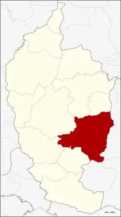 District location in Maha Sarakham province | |
| Coordinates: 15°50′48″N 103°22′48″E / 15.84667°N 103.38000°E | |
| Country | Thailand |
| Province | Maha Sarakham |
| Seat | Nong Saeng |
| Area | |
| • Total | 605.77 km2 (233.89 sq mi) |
| Population (2008) | |
| • Total | 114,020 |
| • Density | 188.1/km2 (487/sq mi) |
| Time zone | UTC+7 (ICT) |
| Postal code | 44120 |
| Geocode | 4409 |
Wapi Pathum (Thai: วาปีปทุม, pronounced [wāː.pīː pā.tʰūm]) is a district (amphoe) of Maha Sarakham province, northeastern Thailand.
Geography
Neighbouring districts are (from the south clockwise): Na Dun, Na Chueak, Borabue, Mueang Maha Sarakham, and Kae Dam of Maha Sarakham Province; Si Somdet, Chaturaphak Phiman, Kaset Wisai, and Pathum Rat of Roi Et province.
History
The district dates back to Mueang Wapi Pathum, which was converted into a district around 1900.
Administration
The district is divided into 15 sub-districts (tambons), which are further subdivided into 240 villages (mubans). Nong Saeng is a sub-district municipality (thesaban tambon) which covers parts of tambon Nong Saeng. There are a further 15 tambon administrative organizations (TAO).
| No. | Name | Thai | Villages | Pop.[1] |
|---|---|---|---|---|
| 1. | Nong Saeng | หนองแสง | 28 | 21,063 |
| 2. | Kham Pom | ขามป้อม | 16 | 6,589 |
| 3. | Suea Kok | เสือโก้ก | 19 | 10,319 |
| 4. | Dong Yai | ดงใหญ่ | 16 | 5,013 |
| 5. | Pho Chai | โพธิ์ชัย | 12 | 4,500 |
| 6. | Hua Ruea | หัวเรือ | 21 | 10,486 |
| 7. | Khaen | แคน | 17 | 6,727 |
| 8. | Ngua Ba | งัวบา | 19 | 8,069 |
| 9. | Na Kha | นาข่า | 16 | 8,823 |
| 10. | Ban Wai | บ้านหวาย | 17 | 7,410 |
| 11. | Nong Hai | หนองไฮ | 17 | 7,855 |
| 12. | Pracha Phatthana | ประชาพัฒนา | 11 | 4,487 |
| 13. | Nong Thum | หนองทุ่ม | 10 | 3,987 |
| 14. | Nong Saen | หนองแสน | 10 | 4,319 |
| 15. | Khok Si Thonglang | โคกสีทองหลาง | 11 | 4,373 |
References
- ↑ "Population statistics 2008". Department of Provincial Administration.
External links
- amphoe.com (Thai)
This article is issued from Wikipedia. The text is licensed under Creative Commons - Attribution - Sharealike. Additional terms may apply for the media files.