T04 Waseda Station 早稲田駅 | |||||||||||
|---|---|---|---|---|---|---|---|---|---|---|---|
 | |||||||||||
| Japanese name | |||||||||||
| Shinjitai | 早稲田駅 | ||||||||||
| Kyūjitai | 早稻田驛 | ||||||||||
| Hiragana | わせだえき | ||||||||||
| General information | |||||||||||
| Location | 12 Waseda-Minamichō, Shinjuku City, Tokyo Japan | ||||||||||
| Operated by | |||||||||||
| Line(s) | T Tozai Line | ||||||||||
| Platforms | 2 side platforms | ||||||||||
| Tracks | 2 | ||||||||||
| Construction | |||||||||||
| Structure type | Underground | ||||||||||
| Other information | |||||||||||
| Station code | T-04 | ||||||||||
| History | |||||||||||
| Opened | 23 December 1964 | ||||||||||
| Services | |||||||||||
| |||||||||||
| Location | |||||||||||
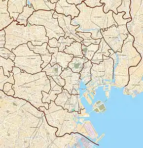
 Waseda Station Location within Special wards of Tokyo  Waseda Station Waseda Station (Tokyo Bay and Bōsō Peninsula)  Waseda Station Waseda Station (Tokyo)  Waseda Station Waseda Station (Japan) | |||||||||||
Waseda Station (早稲田駅, Waseda-eki) is a subway station on the Tokyo Metro Tozai Line in Shinjuku, Tokyo, Japan, operated by Tokyo Metro. Its station number is T-04. It is separate from Waseda Station on the Tokyo Sakura Tram.
Lines
Waseda Station is served by the Tokyo Metro Tōzai Line.
Platforms
| 1 | T Tozai Line | for Ōtemachi, Tōyōchō, Nishi-Funabashi JB Chuo-Sobu Line for Tsudanuma TR Toyo Rapid Railway Line for Tōyō-Katsutadai |
| 2 | T Tozai Line | for Nakano JB Chuo-Sobu Line for Mitaka |
 Platforms
History
The station opened on 23 December 1964.
The station facilities were inherited by Tokyo Metro after the privatization of the Teito Rapid Transit Authority (TRTA) in 2004.[1]
Surrounding area
- Totsukamachi area
- Toyama area
- Kikuicho area
- Waseda University Junior and Senior High School
- Waseda University - Waseda and Kikuicho Campuses
References
- ↑ "「営団地下鉄」から「東京メトロ」へ" [From "Teito Rapid Transit Authority" to "Tokyo Metro"]. Tokyo Metro Online. 8 July 2006. Archived from the original on 16 May 2012. Retrieved 29 May 2022.
External links
Wikimedia Commons has media related to Waseda Station (Tokyo Metro).
- Tokyo Metro station information(in English)
35°42′21″N 139°43′20″E / 35.705714°N 139.722139°E
This article is issued from Wikipedia. The text is licensed under Creative Commons - Attribution - Sharealike. Additional terms may apply for the media files.