Waumandee, Wisconsin | |
|---|---|
 Waumandee | |
| Coordinates: 44°18′11″N 91°42′21″W / 44.30306°N 91.70583°W | |
| Country | United States |
| State | Wisconsin |
| County | Buffalo |
| Town | Waumandee |
| Area | |
| • Total | 0.174 sq mi (0.45 km2) |
| • Land | 0.174 sq mi (0.45 km2) |
| • Water | 0 sq mi (0 km2) |
| Elevation | 768 ft (234 m) |
| Population (2010) | |
| • Total | 68 |
| • Density | 390/sq mi (150/km2) |
| Time zone | UTC-6 (Central (CST)) |
| • Summer (DST) | UTC-5 (CDT) |
| Area code | 608 |
| GNIS feature ID | 1576313[1] |
Waumandee is an unincorporated census-designated place located in the town of Waumandee, in Buffalo County, Wisconsin, United States. Waumandee is located on County Highway U 8.5 miles (13.7 km) northeast of Cochrane.[2] As of the 2010 census, its population is 68.[3]
References
- ↑ U.S. Geological Survey Geographic Names Information System: Waumandee (CDP), Wisconsin
- ↑ Buffalo County (PDF) (Map). Wisconsin Department of Transportation. Retrieved November 12, 2010.
- ↑ "U.S. Census website". U.S. Census Bureau. Retrieved April 20, 2011.
Municipalities and communities of Buffalo County, Wisconsin, United States | ||
|---|---|---|
| Cities | 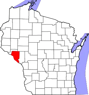 | |
| Villages | ||
| Towns | ||
| CDPs | ||
| Unincorporated communities | ||
| Ghost towns | ||
This article is issued from Wikipedia. The text is licensed under Creative Commons - Attribution - Sharealike. Additional terms may apply for the media files.