| Weiherkopf | |
|---|---|
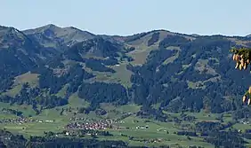
 Bolsterlanger Horn and Weiherkopf. Left rear: the Riedberger Horn | |
| Highest point | |
| Elevation | 1,665 m above sea level (NHN) (5,463 ft) |
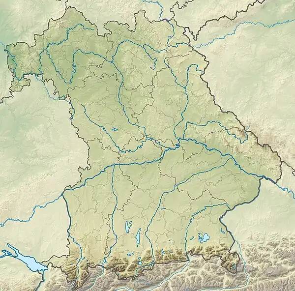
| Coordinates | 47°27′54″N 10°12′04″E / 47.465091°N 10.201185°E |
| Geography | |
 Weiherkopf | |
| Parent range | Hörner group, Allgäu Alps |
| Geology | |
| Type of rock | Flysch |
| Climbing | |
| First ascent | by local people |
The Weiherkopf is a summit in the Hörner Group within the Allgäu Alps in Bavaria, Germany, with a height of 1,665 m.
Geography

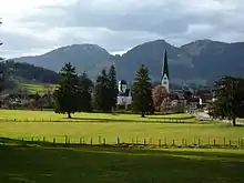
The peak rises within the Nagelfluhkette Nature Park. To the north is Immenstadt, to the east Fischen im Allgäu. To the southeast lies Oberstdorf and to the west is Balderschwang. Near the summit are the neighbouring peaks of the Bolsterlanger Horn to the southwest and the Rangiswanger Horn to the north.
Character
The Weiherkopf is a "relatively large summit, half covered in open meadow and half with woodland",[1] which is known for its extensive views from the Grünten to the Großer Widderstein.[2]
History of the name

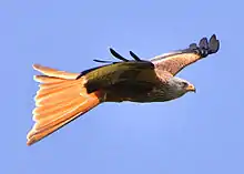
In 18th century maps the mountain is described as the Veier; but, from 1940, in the topographical map of Fischen as the Weiher Kopf. "A pond [Weiher] from which the name might have been derived can no longer be identified".[3] Steiner believes it is, however, entirely plausible that the mountain might once have been called the Weihenkopf. "This name would have meant "peak where kites liked to live. e.g. the red kite".[4] Gabelweihe is an old German name for the red kite; the modern name is Roter Milan.
Tourism and access
Cableways
The Hörnerbahn six-seater gondola lift has two sections and enables access to the Weiherkopf from Bolsterlang. The first section of the cableway runs to the middle station at 1,350 m, the departure point for various walks around the Weiherkopf. The second section runs from the middle station to the ridge of Horngrat, 1,540 m, between the Bolsterlanger Horn and the Weiherkopf.
In summer 2013 the Weiherkopf drag lift, which was over 40 years old, was replaced by the modern couple-able six-seater Weiherkopfbahn.[5]
Der Weiherkopf is used both in summer and winter as the start point for paragliders.
Summer
In the summer season it is possible to walk a 'panorama way' between the summits. The Weiherkopf is an intermediate objective on this route. The main path is called the Allgäu Hörner Tour (Allgäuer Hörnertour), which is also negotiable in winter, but is not then waymarked.
Winter
In the winter season it is possible to ski from the summit on a FIS downhill, slalom and snowboard run.
The Weiherkopf is also a popular area for ski touring and snowshoe walkers.
References
- ↑ so Dieter Seibert in: Allgäuer Alpen und Ammergauer Alpen. Alpenvereinsführer, publ. by the German and Austrian Alpine Clubs, Bergverlag Rother, München 2004, 16th edn. ISBN 3-7633-1126-2, p. 146
- ↑ Weiherkopf, in: Herbert Mayr, Allgäuer Alpen, Kompass Wanderführer 925, Kompass-Karten-GmbH, Rum 2005, 2nd edn., p. 36
- ↑ According to: Thaddäus Steiner, Allgäuer Bergnamen, Lindenberg 2007, p. 214, ISBN 978-3-89870-389-5
- ↑ Thaddäus Steiner, Allgäuer Bergnamen, Lindenberg 2007, p. 215
- ↑ Skigebiete modernisiert at bolsterlang.de, retrieved 29 January 2017.
Literature
- Weiherkopf und Großer Ochsenkopf, in: Herbert Mayr, Allgäuer Alpen, Kompass Wanderführer 925, Kompass-Karten-GmbH, Rum 2005, 2nd edn., pp. 36–37, ISBN 3-85491-201-3