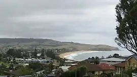
| Werri Beach New South Wales | |||||||||||||||
|---|---|---|---|---|---|---|---|---|---|---|---|---|---|---|---|
 View of Gerringong, Werri Beach and surrounding Headlands | |||||||||||||||
 Werri Beach | |||||||||||||||
| Coordinates | 34°43′47″S 150°50′02″E / 34.72972°S 150.83389°E | ||||||||||||||
| Population | 562 (2016 census)[1] | ||||||||||||||
| Postcode(s) | 2534 | ||||||||||||||
| LGA(s) | Municipality of Kiama | ||||||||||||||
| State electorate(s) | Kiama | ||||||||||||||
| Federal division(s) | Gilmore | ||||||||||||||
| |||||||||||||||
Werri Beach is a town in the Illawarra, south of Kiama and immediately north of Gerringong in New South Wales, Australia. It is located on the coast of the Tasman Sea to the east of the Princes Highway.[2] At the 2016 census, it had a population of 562.[1]
References
- 1 2 Australian Bureau of Statistics (27 June 2017). "Werri Beach". 2016 Census QuickStats. Retrieved 20 July 2017.
- ↑ "Werri Beach". Geographical Names Board of New South Wales. New South Wales Government. Retrieved 20 July 2017.
Wikimedia Commons has media related to Werri Beach, New South Wales.
This article is issued from Wikipedia. The text is licensed under Creative Commons - Attribution - Sharealike. Additional terms may apply for the media files.