Willowmore | |
|---|---|
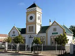
 Town hall | |
   | |
| Coordinates: 33°17′S 23°29′E / 33.283°S 23.483°E | |
| Country | South Africa |
| Province | Eastern Cape |
| District | Sarah Baartman |
| Municipality | Dr Beyers Naudé |
| Area | |
| • Total | 21.74 km2 (8.39 sq mi) |
| Population (2011)[1] | |
| • Total | 7,678 |
| • Density | 350/km2 (910/sq mi) |
| Racial makeup (2011) | |
| • Black African | 10.0% |
| • Coloured | 86.3% |
| • Indian/Asian | 0.2% |
| • White | 3.0% |
| • Other | 0.6% |
| First languages (2011) | |
| • Afrikaans | 94.6% |
| • Xhosa | 3.2% |
| • English | 1.2% |
| • Other | 1.0% |
| Time zone | UTC+2 (SAST) |
| Postal code (street) | 6445 |
| PO box | 6445 |
| Area code | 044 |
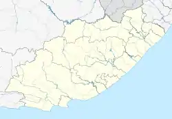
Willowmore is a town in Sarah Baartman District Municipality in the Eastern Cape province of South Africa.
The town is situated 140 km north-east of Knysna and 117 km south-west of Aberdeen. It was laid out in 1862 on the farm The Willows. It is uncertain whether the name is derived from this farm name and that of its owner, William Moore, or from the maiden name of Petronella Catharina Lehmkuhl and a willow-tree near her house.[2]
References
- 1 2 3 4 "Main Place Willowmore". Census 2011.
- ↑ "Dictionary of Southern African Place Names (Public Domain)". Human Science Research Council. p. 473.
This article is issued from Wikipedia. The text is licensed under Creative Commons - Attribution - Sharealike. Additional terms may apply for the media files.
.svg.png.webp)