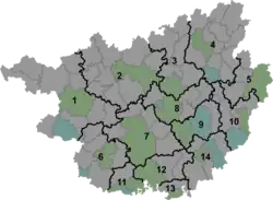
Xinhua Township
新华乡 | |
|---|---|
 Xinhua Township Location in Guangxi | |
| Coordinates: 24°50′46″N 111°24′49″E / 24.84611°N 111.41361°E | |
| Country | China |
| Autonomous Region | Guangxi |
| Prefecture-level city | Hezhou |
| Autonomous county | Fuchuan Yao Autonomous County |
| Area | |
| • Total | 103.6 km2 (40.0 sq mi) |
| Population (2018) | |
| • Total | 18,500 |
| • Density | 180/km2 (460/sq mi) |
| Time zone | UTC+08:00 (China Standard) |
| Postal code | 542707 |
| Area code | 0774 |
Xinhua Township (simplified Chinese: 新华乡; traditional Chinese: 新華鄉; pinyin: Xīnhuá Xiāng; lit. 'New China Township') is a township in Fuchuan Yao Autonomous County, Guangxi, China.[1] As of the 2018 census it had a population of 18,500 and an area of 103.6-square-kilometre (40.0 sq mi).
Etymology
The name of "Xinhua" means "New China".
Administrative division
As of 2016, the township is divided into one community and ten villages:
- Xinhua Community (新华社区)
- Dongwan (东湾村)
- Xinhua (新华村)
- Jingwan (井湾村)
- Panba (盘坝村)
- Lianshantang (莲山塘村)
- Pingyuan (坪源村)
- Luping (路坪村)
- Xianfeng (先锋村)
- Luxi (路溪村)
- Longji (龙集村)
History
It was incorporated as a township in 1984.
Geography
The township is located in eastern Fuchuan Yao Autonomous County.[1] It borders Fuli Town in the north, Jianghua Yao Autonomous County in the east, Baisha Town in the south, and Fuyang Town in the west.[1]
Economy
The township's economy is based on agriculture.[1] Significant crops include grains, corn, peanut, sweet potato, and pepper.[1] Commercial crops include tobacco and vegetables.[1]
Transportation
The County Road X723 passes across the town.
References
Bibliography
- Xia Zhenlin, ed. (2007). "Administrative divisions" 行政区划. 《富川瑶族自治县概况》 [General Situation of Fuchuan Yao Autonomous County] (in Chinese). Beijing: Nationalities Publishing House. ISBN 978-7-105-08613-9.