Xixiu
西秀区 | |
|---|---|
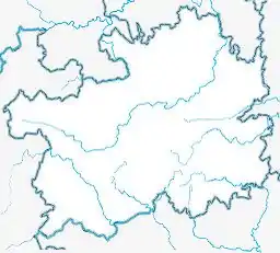 Xixiu Location of the seat in Guizhou 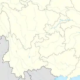 Xixiu Xixiu (Southwest China) | |
| Coordinates (Xixiu District government): 26°14′43″N 105°57′55″E / 26.2454°N 105.9652°E | |
| Country | China |
| Province | Guizhou |
| Prefecture-level city | Anshun |
| District seat | Dongguan Subdistrict |
| Area | |
| • Total | 1,705 km2 (658 sq mi) |
| Population (2020 census)[2] | |
| • Total | 870,441 |
| • Density | 510/km2 (1,300/sq mi) |
| Time zone | UTC+8 (China Standard) |
| Postal code | 561000 |
| Website | www |
Xixiu District (simplified Chinese: 西秀区; traditional Chinese: 西秀區; pinyin: Xīxiù Qū) is a district in the prefecture-level city of Anshun, Guizhou Province, China. The district spans an area of 1,705 square kilometres, and has a population of 765,399 people as of the 2010 Chinese Census.[1][3]
Geography
The district is home to a number of rivers which belong to the larger Yangtze River watershed and the Pearl River watershed.[1] Much of the district's landscape is characterized by karst topography.[1]
Climate
Xixiu District has an average annual temperature of 14 °C, and an average annual precipitation of 1356 millimetres.[1]
Administrative divisions
Xixiu District administers 8 subdistricts, 10 towns, 2 townships, and 5 ethnic townships.[4]
|
|
- 5 ethnic townships
- Xinchang Buyei and Miao Ethnic Township (新场布依族苗族乡)
- Yanla Miao and Buyei Ethnic Township (岩腊苗族布依族乡)
- Jichang Buyei and Miao Ethnic Township (鸡场布依族苗族乡)
- Yangwu Buyei and Miao Ethnic Township (杨武布依族苗族乡)
- Huangla Buyei and Miao Ethnic Township (黄腊布依族苗族乡)
Economy
In 2018, the district's GDP totaled 32.59 billion Yuan and retail sales totaled 7.956 billion Yuan.[5]
Significant mineral deposits in Xixiu District include coal, iron, and marble.[1]
Transportation
The Guizhou–Huangping Highway (贵黄高速公路), a section of National Highway 320 runs through the district.[1]
The Guizhou–Kunming railway and the Anshun–Liupanshui intercity railway both run through the district.[1]
References
- 1 2 3 4 5 6 7 8 西秀区概况地图. xzqh.org (in Chinese). 2015-02-27. Archived from the original on 2020-07-11. Retrieved 2020-07-11.
- ↑ "安顺市第七次全国人口普查公报(第一号)——全市人口情况" (in Chinese). Government of Anshun. 2021-06-09.
- ↑ 西秀区历史沿革. xzqh.org (in Chinese). 2015-02-27. Archived from the original on 2020-07-11. Retrieved 2020-07-11.
- ↑ 2019年统计用区划代码. stats.gov.cn (in Chinese). 2019. Archived from the original on 2020-07-11. Retrieved 2020-07-11.
- ↑ 西秀简介. xixiu.gov.cn (in Chinese). Xixiu District People's Government. Archived from the original on 2019-12-30. Retrieved 2020-07-11.