Yaha
ยะหา | |
|---|---|
 Yaha District Office | |
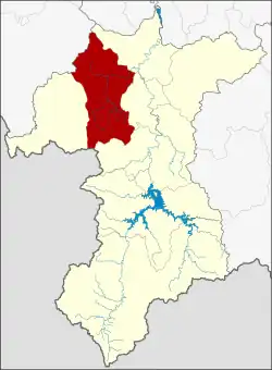 District location in Yala province | |
| Coordinates: 6°28′42″N 101°8′6″E / 6.47833°N 101.13500°E | |
| Country | Thailand |
| Province | Yala |
| Subdistricts | 7 |
| Mubans | 49 |
| Area | |
| • Total | 500.0 km2 (193.1 sq mi) |
| Population (2014) | |
| • Total | 60,091 |
| • Density | 103.1/km2 (267/sq mi) |
| Time zone | UTC+7 (ICT) |
| Postal code | 95120 |
| Geocode | 9505 |
Yaha (Thai: ยะหา, pronounced [já(ʔ).hǎː]; Pattani Malay: ยาฮา, pronounced [jāː.hāː]) is a district (amphoe) in the western part of Yala province, southern Thailand.
History
Yaha was separated from Mueang Yala to create the district in 1907.
Geography
Neighboring districts are (from the west clockwise): Kabang of Yala province; Saba Yoi of Songkhla province; Mueang Yala, Krong Pinang, and Bannang Sata of Yala province; and Kedah state of Malaysia.
Administration
Central administration
Yaha is divided into seven sub-districts (tambons), which are further subdivided into 49 administrative villages (mubans).
| No. | Name | Thai | Villages | Pop.[1] |
|---|---|---|---|---|
| 1. | Yaha | ยะหา | 9 | 14,837 |
| 2. | La-ae | ละแอ | 6 | 4,412 |
| 3. | Patae | ปะแต | 9 | 12,898 |
| 4. | Baro | บาโร๊ะ | 8 | 9,756 |
| 6. | Tachi | ตาชี | 5 | 2,080 |
| 7. | Ba-ngoi Sinae | บาโงยซิแน | 6 | 7,823 |
| 8. | Katong | กาตอง | 6 | 8,285 |
Numbers 5 and 9 belong to the tambons which now form Kabang District.
Local administration
There are two sub-district municipalities (thesaban tambons) in the district:
- Yaha (Thai: เทศบาลตำบลยะหา) consisting of parts of sub-district Yaha.
- Patae (Thai: เทศบาลตำบลปะแต) consisting of sub-district Patae.
There are six sub-district administrative organizations (SAO) in the district:
- Yaha (Thai: องค์การบริหารส่วนตำบลยะหา) consisting of parts of sub-district Yaha.
- La-ae (Thai: องค์การบริหารส่วนตำบลละแอ) consisting of sub-district La-ae.
- Baro (Thai: องค์การบริหารส่วนตำบลบาโร๊ะ) consisting of sub-district Baro.
- Tachi (Thai: องค์การบริหารส่วนตำบลตาชี) consisting of sub-district Tachi.
- Ba-ngoi Sinae (Thai: องค์การบริหารส่วนตำบลบาโงยซิแน) consisting of sub-district Ba-ngoi Sinae.
- Katong (Thai: องค์การบริหารส่วนตำบลกาตอง) consisting of sub-district Katong.
References
- ↑ "Population statistics 2014" (in Thai). Department of Provincial Administration. Retrieved 2015-06-22.
External links
- amphoe.com (in Thai)