Yasynuvata
| |
|---|---|
 | |
 Flag  Coat of arms | |
 Yasynuvata Location of Yasynuvata  Yasynuvata Yasynuvata (Ukraine) | |
| Coordinates: 48°7′40″N 37°51′45″E / 48.12778°N 37.86250°E | |
| Country | |
| Oblast | |
| Raion | Donetsk Raion |
| Hromada | Yasynuvata urban hromada |
| Founded | 1872 |
| City status | 1936 |
| Area | |
| • Total | 19 km2 (7 sq mi) |
| Elevation | 257 m (843 ft) |
| Population (2022)[1] | |
| • Total | 34,144 |
| • Density | 1,800/km2 (4,700/sq mi) |
| Postal code | 86000—86015 |
| Area code | +380-6236 |
| Climate | Warm summer subtype |
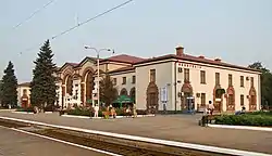
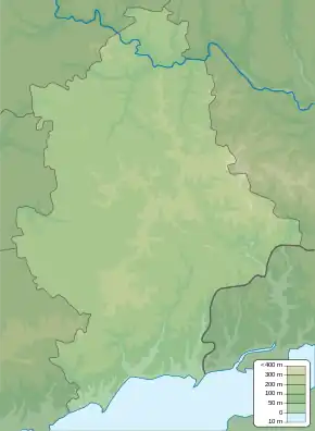
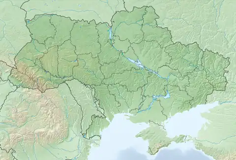
Yasynuvata (Ukrainian: Ясинува́та, pronounced [jɐsɪnʊˈwɑtɐ]; Russian: Ясинова́тая, romanized: Yasinovátaya, pronounced [jɪsʲɪnɐˈvatəjə]) is a city in Donetsk Oblast, eastern Ukraine. It was incorporated as a city of oblast significance until the 2020 administrative reform. It also served as the administrative center of Yasynuvata Raion until it was dissolved in 2020. It is located 21 kilometres (13 mi) from Donetsk, the administrative center of the oblast. Yasynuvata is a large railway crossroad. Its population is approximately 34,144 (2022 estimate).[1]
History
Starting mid-April 2014 pro-Russian separatists captured several towns and cities across in Donetsk and Luhansk Districts;[2][3] including Yasynuvata.[4] On 17 August 2014, Ukrainian forces reportedly took the city from the pro-Russian separatists.[4] But fighting for control of the city continued.[5] On 19 August Ukrainian troops claimed they were clearing Yasynuvata of remaining separatist forces after its victory ("conducting a mopping-up operation").[6] Ukrainian military was forced to retreat from the town in mid-September 2014, and since then the Government of Ukraine have recognised it to be under Russian occupation.[7] On 30 September 2022, Russian Federation unilaterally annexed Yasynuvata with other areas of Donetsk Oblast that are under Russian military occupation.
Due to the war situation railway operation has ceased in 2014.[8]
According to the OSCE the area between Yasynuvata and neighboring Ukrainian army controlled Avdiivka is one of the hotspots of the War in Donbass.[9][10][11]
Demographics
As of the 2001 Ukrainian census:[12]
- Ethnicity
- Ukrainians: 68.9%
- Russians: 28.7%
- Belarusians: 0.6%
- Armenians: 0.4%
Notable people
References
- 1 2 Чисельність наявного населення України на 1 січня 2022 [Number of Present Population of Ukraine, as of January 1, 2022] (PDF) (in Ukrainian and English). Kyiv: State Statistics Service of Ukraine. Archived (PDF) from the original on 4 July 2022.
- ↑ Ragozin, Leonid (16 April 2014). "Vladimir Putin is Accidentally Bringing Eastern and Western Ukraine Together". The New Republic.
- ↑ "Donbass defenders put WWII tank back into service".
- 1 2 "Ukraine Fighting Clouds Diplomatic Push". Wall Street Journal. 18 August 2014.
- ↑ "Saur-Mohyla under control of Ukrainian army, heavy fighting in Yasynuvata - Aug. 18, 2014". 18 August 2014.
- ↑ "Ukraine says battles raging in heart of rebel-held Lugansk".
- ↑ "Складні часи – складні рішення: економічна ізоляція Донбасу" (in Ukrainian). Archived from the original on 2019-12-30. Retrieved 2023-09-03.
- ↑ Lok-Magazin n° 11/2014, page 29 (in German)
- ↑ Spike In Fighting In Eastern Ukraine Threatens Fragile Cease-Fire, Radio Free Europe (April 01, 2016)
- ↑ Over half of Donbas truce breaches observed in Yasynuvata, Avdiyivka, Donetsk airport, Interfax-Ukraine (5 August 2016)
- ↑ "Yasynuvata: search results on OSCE page". osce.org. Kyiv: OSCE Special Monitoring Mission (SMM) to Ukraine. Retrieved 5 August 2016.
- ↑ Національний склад та рідна мова населення Донецької області. Розподіл постійного населення за найбільш численними національностями та рідною мовою по міськрадах та районах (in Ukrainian), archived from the original on 2012-02-07
External links