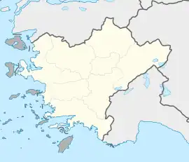
Yeşilhisar | |
|---|---|
 Yeşilhisar Location in Turkey  Yeşilhisar Yeşilhisar (Turkey Aegean) | |
| Coordinates: 38°40′30″N 29°56′14″E / 38.6750°N 29.9372°E | |
| Country | Turkey |
| Province | Afyonkarahisar |
| District | Hocalar |
| Elevation | 1,000 m (3,000 ft) |
| Population (2021) | 1,514 |
| Time zone | TRT (UTC+3) |
| Postal code | 03580 |
Yeşilhisar is a village in the Hocalar District, Afyonkarahisar Province, Turkey.[1] Its population is 1,514 (2021).[2] Before the 2013 reorganisation, it was a town (belde).[3] The postal code for the village is 03580.
Geography
Yeşilhisar is located on the southwest flank of the Ahır Dağ, 84 km south of Kütahya.[4]: 233 The village is located at the western end of the Karahisar Plain and has a continental climate, hot and dry summers, cold and snowy winters. Rainfall is generally sparse. The economy is mainly agriculture accounting for about 60% to 75% of the population with crops including Apples, apricots and Sugar beet and potato are the most important industrial plants.
History
The ancient city of Dioclea (Greek: Διόκλεια Φρυγίας) was located near modern Yeşilhisar (formerly called Ahırhisar),[5] while some assume that it was located near modern Doğlat.[6] Traces of the ancient settlement at Yeşilhisar include a few old inscriptions and a capital dated to the early Byzantine period.[4]: 234
References
- ↑ Köy, Turkey Civil Administration Departments Inventory. Retrieved 15 January 2023.
- ↑ "Address-based population registration system (ADNKS) results dated 31 December 2021" (XLS) (in Turkish). TÜİK. Retrieved 12 January 2023.
- ↑ Law No. 6360, Official Gazette, 6 December 2012 (in Turkish).
- 1 2 Belke, Klaus; Mersich, Norbert (1990). Tabula Imperii Byzantini Bd. 7. Phrygien und Pisidien. Wien: Österreichicshe Akademie der Wissenschaften. ISBN 3-7001-1698-5. Retrieved 19 December 2023.
- ↑ Lund University. Digital Atlas of the Roman Empire.
- ↑ Catholic Encyclopedia: Dioclea