Youyang
酉阳县 · youvyanr xanf Yuyang | |
|---|---|
酉阳土家族苗族自治县 youvyanr bifzivkar befkar zifzifxanf Youyang Tujia and Miao Autonomous County | |
 Gongtan Ancient Town | |
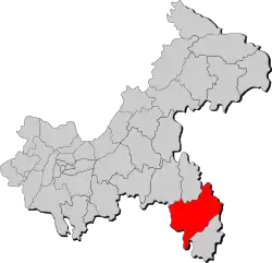
 Location of Youyang County in Chongqing | |
| Coordinates: 28°53′19″N 108°45′50″E / 28.8886°N 108.764°E | |
| Country | China |
| Municipality | Chongqing |
| County seat | Taohuayuan Subdistrict |
| Area | |
| • Total | 5,173 km2 (1,997 sq mi) |
| Population (2020 census)[1] | |
| • Total | 607,338 |
| • Density | 120/km2 (300/sq mi) |
| Time zone | UTC+8 (China Standard) |
| Website | youyang |
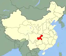
Youyang Tujia and Miao Autonomous County, or Youyang County for short (simplified Chinese: 酉阳土家族苗族自治县; traditional Chinese: 酉陽土家族苗族自治縣; pinyin: YǒuYáng Tǔjiāzú Miáozú Zìzhìxiàn) is located in southeast Chongqing Municipality, China, bordering the provinces of Hunan to the east and Guizhou to the southwest.
The county spans an area of 5,173 km2 (1,997 sq mi), and has a population of approximately 854,400 people as of 2018.[2][3]
History
Youyang was known as Youzhou in ancient times.
Geography
Youyang Tujia Miao Autonomous County is located east of Wu River and west of Youshui River.[2] It is the largest county-level division of Chongqing, having an area of 5,173 km2 (1,997 sq mi).[2]
The county contains about 1.5939 million mu (1,062.6 km2 or 410.3 sq mi) of arable land, 4.46 million mu (2,973.3 km2 or 1,148.0 sq mi) of forested land, and 2.92 million mu (1,946.6 km2 or 751.6 sq mi) of grassland.
The Wuling Mountains run through the county, and the county's highest point reaches 1,895 metres (6,217 ft) above sea level.[2]
Climate
| Climate data for Youyang Tujia and Miao Autonomous County (1991–2011 normals, extremes 1971–2010) | |||||||||||||
|---|---|---|---|---|---|---|---|---|---|---|---|---|---|
| Month | Jan | Feb | Mar | Apr | May | Jun | Jul | Aug | Sep | Oct | Nov | Dec | Year |
| Record high °C (°F) | 21.4 (70.5) |
27.9 (82.2) |
30.6 (87.1) |
33.4 (92.1) |
35.3 (95.5) |
35.6 (96.1) |
36.7 (98.1) |
37.5 (99.5) |
35.6 (96.1) |
31.9 (89.4) |
26.7 (80.1) |
20.9 (69.6) |
37.5 (99.5) |
| Mean daily maximum °C (°F) | 7.5 (45.5) |
10.1 (50.2) |
14.2 (57.6) |
20.2 (68.4) |
24.4 (75.9) |
27.3 (81.1) |
30.2 (86.4) |
30.2 (86.4) |
26.4 (79.5) |
20.3 (68.5) |
15.9 (60.6) |
10.1 (50.2) |
19.7 (67.5) |
| Daily mean °C (°F) | 4.1 (39.4) |
6.3 (43.3) |
9.8 (49.6) |
15.2 (59.4) |
19.5 (67.1) |
22.7 (72.9) |
25.3 (77.5) |
24.9 (76.8) |
21.3 (70.3) |
15.9 (60.6) |
11.3 (52.3) |
6.3 (43.3) |
15.2 (59.4) |
| Mean daily minimum °C (°F) | 1.6 (34.9) |
3.7 (38.7) |
6.8 (44.2) |
11.8 (53.2) |
15.9 (60.6) |
19.4 (66.9) |
21.8 (71.2) |
21.3 (70.3) |
17.9 (64.2) |
13.1 (55.6) |
8.3 (46.9) |
3.7 (38.7) |
12.1 (53.8) |
| Record low °C (°F) | −5.6 (21.9) |
−4.5 (23.9) |
−2.3 (27.9) |
1.4 (34.5) |
5.9 (42.6) |
11.5 (52.7) |
14.6 (58.3) |
14.3 (57.7) |
10.7 (51.3) |
4.0 (39.2) |
−1.7 (28.9) |
−4.7 (23.5) |
−5.6 (21.9) |
| Average precipitation mm (inches) | 30.9 (1.22) |
38.3 (1.51) |
57.1 (2.25) |
114.8 (4.52) |
201.8 (7.94) |
232.4 (9.15) |
199.7 (7.86) |
153.8 (6.06) |
87.1 (3.43) |
116.9 (4.60) |
61.5 (2.42) |
22.3 (0.88) |
1,316.6 (51.84) |
| Average precipitation days | 11.8 | 11.7 | 15.0 | 15.7 | 17.3 | 16.9 | 15.7 | 14.2 | 10.6 | 15.3 | 10.5 | 10.4 | 165.1 |
| Average snowy days | 8.5 | 4.4 | 2 | 0 | 0 | 0 | 0 | 0 | 0 | 0 | 0.4 | 3.9 | 19.2 |
| Average relative humidity (%) | 76 | 77 | 78 | 79 | 80 | 82 | 81 | 79 | 79 | 81 | 78 | 76 | 79 |
| Mean monthly sunshine hours | 41.6 | 39.1 | 63.6 | 82.4 | 102.7 | 91.6 | 147.2 | 158.3 | 115.9 | 73.9 | 75.4 | 53.5 | 1,045.2 |
| Percent possible sunshine | 13 | 12 | 17 | 21 | 24 | 22 | 35 | 39 | 32 | 21 | 24 | 17 | 23 |
| Source: China Meteorological Administration[4][5][6] | |||||||||||||
Administrative divisions
Youyang Tujia and Miao Autonomous County is divided into 2 subdistricts, 19 towns, and 18 townships.[7] These are then divided into 8 residential communities, and 270 administrative villages.[2]
|
|
Demographics
As of 2018, the county has a population of approximately 854,400 people.[3] Of this, 275,000 live in urban areas, and 579,400 live in rural areas.[3]
Vital statistics
In 2018, the county registered a birth rate of 10.89 per thousand, a death rate of 5.74 per thousand, giving it a rate of natural increase of 5.15 per thousand.[3]
Ethnic groups
Youyang Tujia and Miao Autonomous County is home to 16 ethnic minorities, including the Tujia and Miao people, for which the county is named.[3]
| Group | Population (total) | Population (percent) |
|---|---|---|
| Tujia | 689,700 | 80.72% |
| Miao | 97,100 | 11.36% |
| Han | 67,200 | 7.87% |
| Other | 400 | 0.05% |
| Total | 854,400 | 100.00% |
Culture
The county is nicknamed the "Cradle of Tujia people" for its rich Tujia culture.
It is the home of the Baishou Dance, a symbolic tradition of Tujia people.[8] It is a traditional dance which involves waving hands to convey stories of human origins, myths and legends, ethnic migration, ancient wars, hunting and fishing, forestry, labor, food, and other aspects of social life.[8] The dance was added to the second batch of the China National Intangible Cultural Heritage List on June 7, 2008.[8]
The county is also home to a number of traditional folk songs, which perhaps date back to the Southern Song Dynasty.[8] The folk songs are popular at festivals, weddings, funerals, and other activities.[8]
Economy
The county has a labor force 40-50% cheaper than that of coastal areas. It is one of the counties with the most water resources in China, and has more than 20 kinds of mineral resources. Youyang is also a "Sanmu" (Chinese: 三木) production base, as it grows three major plants used in Chinese medicine: Eucommia ulmoides (Chinese: 杜仲), Magnolia officinalis (Chinese: 厚朴), and Phellodendron amurense (Chinese: 黄柏).[2] The country as a whole grows about 1,200 kinds of Chinese herbal medicine materials, and is home to large amounts of Artemisia annua.[2]
Tourism
Taohuayuan
Taohuayuan (Chinese: 桃花源) is a 5A Tourist Attraction, the highest rank of designated attractions in China.[2] Located in the northern corner of the county, Taohuayuan is a place at first described in The Peach Blossom Spring written by Tao Yuanming, a famous writer of the Eastern Jin Dynasty (317-420). It is notable that there are more than one Taohuayuan spots in China, and the one in Youyang is a nationwide recognised Taohuayuan.
Gongtan Ancient Town
Gongtan Ancient Town (Chinese: 龚滩古镇) is located at the intersection of Wu River and Apeng River, and it is a 4A Tourist Attraction. It has a history of more than 1,700 years. More than 200 courtyards and stilted building from Ming Dynasty and Qing Dynasty are preserved in Gongtan.
Wu River Gallery
Wu River Gallery is the 60 km (37 mi) long, naturally formed river bank of Wu River in Chongqing Youyang, and it is a 4A Tourist Attraction. It is famous for the strangely shaped mountains along the gallery.
Longtan Ancient Town
Longtan Ancient Town (Chinese: 龙潭古镇) is an ancient town with ancient wood architecture.
Notable people
- Zhao Shiyan, communist revolutionary
References
- ↑ "重庆市第七次全国人口普查公报(第二号)——地区常住人口情况" (in Chinese). Government of Chongqing. 2021-05-13.
- 1 2 3 4 5 6 7 8 县情介绍 [County Introduction] (in Chinese). Chongqing City Youyang Tujia and Miao Autonomous County People's Government. 2020-01-10. Retrieved 2021-02-28.
- 1 2 3 4 5 6 人口状况 [Population Overview] (in Chinese). Chongqing City Youyang Tujia and Miao Autonomous County People's Government. 2020-01-10. Archived from the original on 2021-02-28. Retrieved 2021-02-28.
- ↑ 中国气象数据网 – WeatherBk Data (in Simplified Chinese). China Meteorological Administration. Retrieved 18 September 2023.
- ↑ 中国气象数据网 (in Simplified Chinese). China Meteorological Administration. Retrieved 18 September 2023.
- ↑ 中国地面国际交换站气候标准值月值数据集(1971-2000年). China Meteorological Administration. Archived from the original on 2013-09-21. Retrieved 2010-05-25.
- ↑ 2020年统计用区划代码(酉阳土家族苗族自治县) [2020 Statistical Division Codes (Youyang Tujia and Miao Autonomous County)] (in Chinese). National Bureau of Statistics of China. 2020. Archived from the original on 2021-02-28. Retrieved 2021-02-28.
- 1 2 3 4 5 民俗文化 [Folk Culture] (in Chinese). Chongqing City Youyang Tujia and Miao Autonomous County People's Government. 2020-01-10. Archived from the original on 2021-02-28. Retrieved 2021-02-28.

