Zaļesje Parish | |
|---|---|
 | |
| Country | Latvia |
| Area | |
| • Total | 108.76 km2 (41.99 sq mi) |
| • Land | 107.05 km2 (41.33 sq mi) |
| • Water | 1.71 km2 (0.66 sq mi) |
| Population (1 January 2023)[2] | |
| • Total | 482 |
| • Density | 4.4/km2 (11/sq mi) |
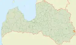
Zaļesje Parish (Latvian: Zaļesjes pagasts) is an administrative unit of Ludza Municipality, its administrative center being the village of Zaļesje.
The place is close to the border with Russia, and the name of the village is a common Russian toponym meaning "place over the woods".
By the 2009 administrative reform, this territorial unit was merged into the Zilupe Municipality. Since 1 July 2021, Zaļesje Parish has been part of Ludza Municipality.[3]
References
- ↑ "Reģionu, novadu, pilsētu un pagastu kopējā un sauszemes platība gada sākumā". Central Statistical Bureau of Latvia. Retrieved 18 January 2023.
- ↑ "Iedzīvotāju skaits pēc tautības reģionos, pilsētās, novados, pagastos, apkaimēs un blīvi apdzīvotās teritorijās gada sākumā (pēc administratīvi teritoriālās reformas 2021. gadā) 2021 - 2022". Central Statistical Bureau of Latvia. Retrieved 3 October 2023.
- ↑ Law on Administrative Territories and Populated Areas
This article is issued from Wikipedia. The text is licensed under Creative Commons - Attribution - Sharealike. Additional terms may apply for the media files.