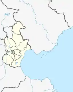
Zhongshanmen Subdistrict
中山门街道 | |
|---|---|
 Highway interchange at the souther corner of the subdistrict, 2009 | |
 Zhongshanmen Subdistrict  Zhongshanmen Subdistrict | |
| Coordinates: 39°06′08″N 117°16′14″E / 39.10222°N 117.27056°E | |
| Country | China |
| Municipality | Tianjin |
| District | Hedong |
| Village-level Divisions | 15 communities |
| Area | |
| • Total | 2.34 km2 (0.90 sq mi) |
| Elevation | 6 m (20 ft) |
| Population (2010) | |
| • Total | 94,762 |
| • Density | 40,000/km2 (100,000/sq mi) |
| Time zone | UTC+8 (China Standard) |
| Postal code | 300181 |
| Area code | 022 |
Zhongshanmen Subdistrict (simplified Chinese: 中山门街道; traditional Chinese: 中山門街道; pinyin: Zhōngshānmén Jiēdào) is a subdistrict located in the southern side of Hedong District, Tianjin. it shares border Shanghang Road and Wanxing Subdistricts to the northeast, Erhaoqiao Subdistrict to the southeast, Fumin Road Subdistrict to the southwest, and Dazhigu Subdistrict to the northwest. It had a total population of 94,762 as of 2010.[1]
Its name Zhongshanmen (Chinese: 中山门; lit. 'Middle Mountain Gate') originated in 1947, when the Nationalist government constructed a series of fortification in Tianjin during the Chinese Civil War. A huge metal gate was installed within this region, along with a inscription reading: "Zhongshanmen". Later people started to refer to the area by this name.[2]
History
| Year | Status | Within |
|---|---|---|
| 1952 - 1956 | Zhongshanmen Worker's New Village | 4th District, Tianjin |
| 1956 - 1961 | Zhongshanmen Subdistrict | Hedong District, Tianin |
| 1961 - 1963 | Zhongshanmen People's Commune | |
| 1963 - 1966 | Zhongshanmen Subdistrict | |
| 1966 - 1968 | Dongfeng Distrct, Tianjin | |
| 1968 - 1978 | Zhongshanmenjie Revolutionary Committee (Southeastern part were made into Erhaoqiao Subdistrict in 1977) | Hedong District, Tianjin |
| 1978 - present | Zhongshanmen Subdistrict
(Part of it was made into Guangning Road subdistrict in 1979, reincorporated in 2000) |
Administrative divisions
At the end of 2021, Zhongshanmen Subdistrict was composed of 15 communities. They are listed in the table below:[3]
| Subdivision Names | Name Transliterations |
|---|---|
| 团结北里 | Tuanjie Beili |
| 和睦北里 | Hemu Beili |
| 和睦西里 | Hemu Xili |
| 友爱南里 | You'ai Nanli |
| 互助南里 | Huzhu Nanli |
| 互助西里 | Huzhu Xili |
| 龙潭路 | Longtanlu |
| 中山门北里 | Zhongshanmen Beili |
| 团结东里 | Tuanjie Dongli |
| 中山门东里 | Zhongshanmen Dongli |
| 丰乐里 | Fengleli |
| 试验楼 | Shiyanlou |
| 中山门四号路 | Zhongshanmen Sihaolu |
| 友爱东里 | You'ai Dongli |
| 格调竹境 | Gediao Zhujing |
References
- ↑ "China: Tiānjīn Municipal Province (Districts and Townships) - Population Statistics, Charts and Map". www.citypopulation.de. Retrieved 2022-11-05.
- 1 2 中华人民共和国政区大典:天津市卷 (in Chinese). 中国社会出版社. 2020.
- ↑ "2021年统计用区划代码和城乡划分代码". www.stats.gov.cn. Retrieved 2022-11-03.