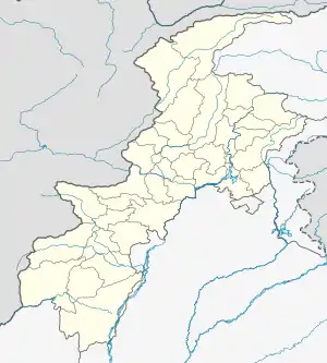
Zira Khel | |
|---|---|
Village | |
 Zira Khel | |
| Coordinates: 33°08′N 70°09′E / 33.14°N 70.15°E | |
| Country | |
| Province | |
| District | North Waziristan |
| Tehsil | Datta Khel |
| Elevation | 842 m (2,762 ft) |
| Population (2017) | |
| • Total | 959 |
| • Estimate () | [1] |
| Time zone | UTC+5 (PST) |
Zira Khel is a village in the Khyber Pakhtunkhwa province of Pakistan. It is located at 33°14'0N 70°15'16E with an altitude of 842 metres (2765 feet) and lies close to the border with Afghanistan.[2]
References
- ↑ "POPULATION AND HOUSEHOLD DETAIL FROM BLOCK TO DISTRICT LEVEL: FATA (NORTH WAZIRISTAN)" (PDF). www.pbscensus.gov.pk. 2018-01-03. Retrieved 2018-04-02.
- ↑ Location of Zira Khel - Falling Rain Genomics
This article is issued from Wikipedia. The text is licensed under Creative Commons - Attribution - Sharealike. Additional terms may apply for the media files.