Atoka, New Mexico | |
|---|---|
 Atoka | |
| Coordinates: 32°46′40″N 104°23′20″W / 32.77778°N 104.38889°W | |
| Country | United States |
| State | New Mexico |
| County | Eddy |
| Area | |
| • Total | 6.79 sq mi (17.59 km2) |
| • Land | 6.76 sq mi (17.51 km2) |
| • Water | 0.03 sq mi (0.08 km2) |
| Elevation | 3,370 ft (1,030 m) |
| Population | |
| • Total | 1,153 |
| • Density | 170.56/sq mi (65.85/km2) |
| Time zone | UTC-7 (Mountain (MST)) |
| • Summer (DST) | UTC-6 (MDT) |
| Area code | 575 |
| GNIS feature ID | 2584053[2] |
Atoka is a census-designated place in Eddy County, New Mexico, United States. Its population was 1,077 as of the 2010 census.[4] U.S. Route 285 passes through the community. The name was derived from an Indian word, probably Choctaw, whose meaning is unknown.[5]
It is within the Artesia Public Schools school district.[6] Artesia High School is the school district's sole comprehensive high school.
Demographics
| Census | Pop. | Note | %± |
|---|---|---|---|
| 2020 | 1,153 | — | |
| U.S. Decennial Census[7][3] | |||
References
- ↑ "ArcGIS REST Services Directory". United States Census Bureau. Retrieved October 12, 2022.
- 1 2 U.S. Geological Survey Geographic Names Information System: Atoka
- 1 2 "Census Population API". United States Census Bureau. Retrieved October 12, 2022.
- ↑ "U.S. Census website". United States Census Bureau. Retrieved May 14, 2011.
- ↑ Julyan, Robert (1996). The Place Names of New Mexico. University of New Mexico Press. p. 24. ISBN 0826316891.
- ↑ "2020 CENSUS - SCHOOL DISTRICT REFERENCE MAP: Eddy County, NM" (PDF). U.S. Census Bureau. Retrieved June 28, 2022. - Text list
- ↑ "Census of Population and Housing". Census.gov. Retrieved June 4, 2016.
Municipalities and communities of Eddy County, New Mexico, United States | ||
|---|---|---|
| Cities | 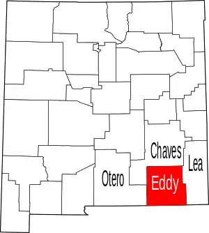 Map of New Mexico highlighting Eddy County | |
| Villages | ||
| CDPs | ||
| Unincorporated communities | ||
This article is issued from Wikipedia. The text is licensed under Creative Commons - Attribution - Sharealike. Additional terms may apply for the media files.