Bad Erlach | |
|---|---|
_Ulrichskirche.jpg.webp) Saint Ulrich Church | |
 Coat of arms | |
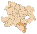
 Bad Erlach Location within Austria | |
| Coordinates: 47°44′02″N 16°12′47″E / 47.73389°N 16.21306°E | |
| Country | Austria |
| State | Lower Austria |
| District | Wiener Neustadt-Land |
| Government | |
| • Mayor | Bärbel Stockinger (ÖVP) |
| Area | |
| • Total | 9.16 km2 (3.54 sq mi) |
| Elevation | 312 m (1,024 ft) |
| Population (2018-01-01)[2] | |
| • Total | 3,084 |
| • Density | 340/km2 (870/sq mi) |
| Time zone | UTC+1 (CET) |
| • Summer (DST) | UTC+2 (CEST) |
| Postal code | 2822 |
| Area code | 02627 |
| Vehicle registration | WB |
| Website | www.baderlach.gv.at |
Bad Erlach is a municipality in the district of Wiener Neustadt-Land in the Austrian state of Lower Austria.
Population
| Year | Pop. | ±% |
|---|---|---|
| 1869 | 1,388 | — |
| 1880 | 1,708 | +23.1% |
| 1890 | 1,698 | −0.6% |
| 1900 | 2,036 | +19.9% |
| 1910 | 2,241 | +10.1% |
| 1923 | 1,877 | −16.2% |
| 1934 | 2,054 | +9.4% |
| 1939 | 2,101 | +2.3% |
| 1951 | 2,141 | +1.9% |
| 1961 | 2,122 | −0.9% |
| 1971 | 2,218 | +4.5% |
| 1981 | 2,099 | −5.4% |
| 1991 | 2,184 | +4.0% |
| 2001 | 2,531 | +15.9% |
References
- ↑ "Dauersiedlungsraum der Gemeinden Politischen Bezirke und Bundesländer - Gebietsstand 1.1.2018". Statistics Austria. Retrieved 10 March 2019.
- ↑ "Einwohnerzahl 1.1.2018 nach Gemeinden mit Status, Gebietsstand 1.1.2018". Statistics Austria. Retrieved 9 March 2019.
This article is issued from Wikipedia. The text is licensed under Creative Commons - Attribution - Sharealike. Additional terms may apply for the media files.