Berkenye
Berkina | |
|---|---|
 Berkenye Location of Berkenye | |
| Coordinates: 47°53′24″N 19°04′15″E / 47.89004°N 19.07083°E | |
| Country | |
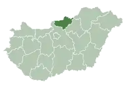
| County | Nógrád |
| Area | |
| • Total | 13.46 km2 (5.20 sq mi) |
| Population (2004) | |
| • Total | 618 |
| • Density | 45.91/km2 (118.9/sq mi) |
| Time zone | UTC+1 (CET) |
| • Summer (DST) | UTC+2 (CEST) |
| Postal code | 2641 |
| Area code | 35 |
Berkenye (German: Berkina) is a village in Nógrád County, Hungary.
| Year | Population |
|---|---|
| 1870 | 371 |
| 1880 | 415 |
| 1890 | 429 |
| 1900 | 482 |
| 1910 | 527 |
| 1920 | 536 |
| 1930 | 588 |
| 1941 | 595 |
| 1949 | 686 |
| 1960 | 699 |
| 1970 | 638 |
| 1980 | 615 |
| 1990 | 604 |
| 2001 | 587 |
| 2011 | 629 |
References
- ↑ "Nógrád county - Data on localities - Population number, population density". Hungarian Central Statistical Office/Központi Statisztikai Hivatal. Retrieved 2021-05-22.
External links
- Street map (in Hungarian)

This article is issued from Wikipedia. The text is licensed under Creative Commons - Attribution - Sharealike. Additional terms may apply for the media files.