Bey | |
|---|---|
Commune | |
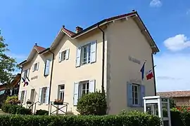 Town hall | |
Location of Bey | |
 Bey  Bey | |
| Coordinates: 46°13′13″N 4°50′48″E / 46.2203°N 4.8467°E | |
| Country | France |
| Region | Auvergne-Rhône-Alpes |
| Department | Ain |
| Arrondissement | Bourg-en-Bresse |
| Canton | Vonnas |
| Intercommunality | Veyle |
| Government | |
| • Mayor (2020–2026) | Michel Gentil[1] |
| Area 1 | 2.77 km2 (1.07 sq mi) |
| Population | 290 |
| • Density | 100/km2 (270/sq mi) |
| Time zone | UTC+01:00 (CET) |
| • Summer (DST) | UTC+02:00 (CEST) |
| INSEE/Postal code | 01042 /01290 |
| Elevation | 175–213 m (574–699 ft) (avg. 210 m or 690 ft) |
| 1 French Land Register data, which excludes lakes, ponds, glaciers > 1 km2 (0.386 sq mi or 247 acres) and river estuaries. | |
Bey (French pronunciation: [bɛ] ⓘ beh; Arpitan: Bês) is a commune in the Ain department in eastern France.
Population
| Year | Pop. | ±% p.a. |
|---|---|---|
| 1968 | 105 | — |
| 1975 | 131 | +3.21% |
| 1982 | 181 | +4.73% |
| 1990 | 195 | +0.94% |
| 1999 | 221 | +1.40% |
| 2007 | 241 | +1.09% |
| 2012 | 260 | +1.53% |
| 2017 | 279 | +1.42% |
| Source: INSEE[3] | ||
See also
References
- ↑ "Répertoire national des élus: les maires". data.gouv.fr, Plateforme ouverte des données publiques françaises (in French). 2 December 2020.
- ↑ "Populations légales 2021". The National Institute of Statistics and Economic Studies. 28 December 2023.
- ↑ Population en historique depuis 1968, INSEE
Wikimedia Commons has media related to Bey (Ain).
This article is issued from Wikipedia. The text is licensed under Creative Commons - Attribution - Sharealike. Additional terms may apply for the media files.