Saint-Rémy | |
|---|---|
Commune | |
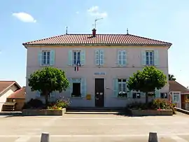 Town hall | |
Location of Saint-Rémy | |
 Saint-Rémy  Saint-Rémy | |
| Coordinates: 46°11′24″N 5°10′09″E / 46.19°N 5.1692°E | |
| Country | France |
| Region | Auvergne-Rhône-Alpes |
| Department | Ain |
| Arrondissement | Bourg-en-Bresse |
| Canton | Bourg-en-Bresse-2 |
| Intercommunality | CA Bassin de Bourg-en-Bresse |
| Government | |
| • Mayor (2021–2026) | Christophe Mallet[1] |
| Area 1 | 7.38 km2 (2.85 sq mi) |
| Population | 943 |
| • Density | 130/km2 (330/sq mi) |
| Time zone | UTC+01:00 (CET) |
| • Summer (DST) | UTC+02:00 (CEST) |
| INSEE/Postal code | 01385 /01310 |
| Elevation | 216–265 m (709–869 ft) |
| 1 French Land Register data, which excludes lakes, ponds, glaciers > 1 km2 (0.386 sq mi or 247 acres) and river estuaries. | |
Saint-Rémy (French pronunciation: [sɛ̃ ʁemi] ⓘ) is a commune in the Ain department in eastern France.
Geography
The Veyle river flows north through the middle of the commune.
Population
| Year | Pop. | ±% p.a. |
|---|---|---|
| 1968 | 302 | — |
| 1975 | 432 | +5.25% |
| 1982 | 551 | +3.54% |
| 1990 | 668 | +2.44% |
| 1999 | 813 | +2.21% |
| 2009 | 871 | +0.69% |
| 2014 | 984 | +2.47% |
| 2020 | 964 | −0.34% |
| Source: INSEE[3] | ||
See also
References
- ↑ "Répertoire national des élus: les maires". data.gouv.fr, Plateforme ouverte des données publiques françaises (in French). 9 August 2021.
- ↑ "Populations légales 2021". The National Institute of Statistics and Economic Studies. 28 December 2023.
- ↑ Population en historique depuis 1968, INSEE
Wikimedia Commons has media related to Saint-Rémy (Ain).
This article is issued from Wikipedia. The text is licensed under Creative Commons - Attribution - Sharealike. Additional terms may apply for the media files.