23°28′11″S 46°41′23″W / 23.4697°S 46.6897°W
Brasilândia | |
|---|---|
 District of the city of São Paulo | |
| Country | |
| State | |
| Municipality | |
| Subprefecture | Freguesia Brasilândia |
| Area | |
| • Total | 21.00 km2 (8.11 sq mi) |
| Population (2007) | |
| • Total | 264,918 |
| • Density | 12,615/km2 (32,670/sq mi) |
| Website | Subprefecture of Freguesia Brasilândia |
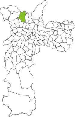
Brasilândia is one of 96 districts in the city of São Paulo, Brazil.[1]
References
- ↑ "Dados Demográficos dos Distritos pertencentes as Subprefeituras". prefeitura.sp.gov.br (in Portuguese). City of São Paulo. Archived from the original on 2012-09-21. Retrieved 28 December 2014.

This article is issued from Wikipedia. The text is licensed under Creative Commons - Attribution - Sharealike. Additional terms may apply for the media files.