Châteauvieux | |
|---|---|
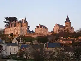 Castle Chateauvieux | |
 Coat of arms | |
Location of Châteauvieux | |
 Châteauvieux 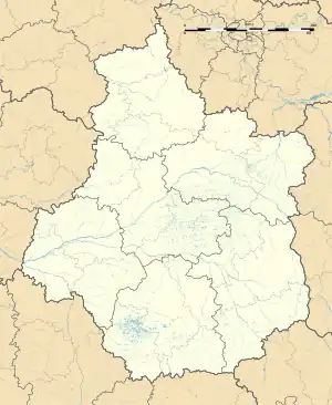 Châteauvieux | |
| Coordinates: 47°13′50″N 1°23′02″E / 47.2306°N 1.3839°E | |
| Country | France |
| Region | Centre-Val de Loire |
| Department | Loir-et-Cher |
| Arrondissement | Romorantin-Lanthenay |
| Canton | Saint-Aignan |
| Intercommunality | Val-de-Cher-Controis |
| Government | |
| • Mayor (2020–2026) | Christian Saux[1] |
| Area 1 | 33.48 km2 (12.93 sq mi) |
| Population | 533 |
| • Density | 16/km2 (41/sq mi) |
| Time zone | UTC+01:00 (CET) |
| • Summer (DST) | UTC+02:00 (CEST) |
| INSEE/Postal code | 41042 /41110 |
| Elevation | 79–160 m (259–525 ft) (avg. 90 m or 300 ft) |
| 1 French Land Register data, which excludes lakes, ponds, glaciers > 1 km2 (0.386 sq mi or 247 acres) and river estuaries. | |
Châteauvieux (French pronunciation: [ʃɑtovjø]) is a commune in the Loir-et-Cher department, central France.[3]
Population
| Year | Pop. | ±% p.a. |
|---|---|---|
| 1968 | 727 | — |
| 1975 | 629 | −2.05% |
| 1982 | 660 | +0.69% |
| 1990 | 584 | −1.52% |
| 1999 | 575 | −0.17% |
| 2007 | 549 | −0.58% |
| 2012 | 550 | +0.04% |
| 2017 | 538 | −0.44% |
| Source: INSEE[4] | ||
Sights
The church of Saint-Hilaire was mostly built in the 13th century in the Plantagenet Gothic style characterised by the cross ribbed cup-shaped vaulting.
See also
References
- ↑ "Répertoire national des élus: les maires" (in French). data.gouv.fr, Plateforme ouverte des données publiques françaises. 13 September 2022.
- ↑ "Populations légales 2021". The National Institute of Statistics and Economic Studies. 28 December 2023.
- ↑ INSEE commune file
- ↑ Population en historique depuis 1968, INSEE
Wikimedia Commons has media related to Châteauvieux (Loir-et-Cher).
This article is issued from Wikipedia. The text is licensed under Creative Commons - Attribution - Sharealike. Additional terms may apply for the media files.