Montrichard-Val-de-Cher | |
|---|---|
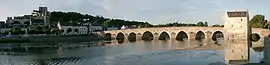 The Cher | |
Location of Montrichard-Val-de-Cher | |
 Montrichard-Val-de-Cher 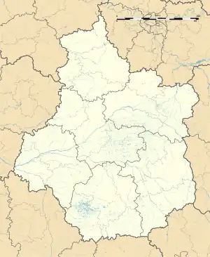 Montrichard-Val-de-Cher | |
| Coordinates: 47°20′35″N 1°11′02″E / 47.343°N 1.184°E | |
| Country | France |
| Region | Centre-Val de Loire |
| Department | Loir-et-Cher |
| Arrondissement | Romorantin-Lanthenay |
| Canton | Montrichard Val de Cher |
| Government | |
| • Mayor (2020–2026) | Damien Hénault[1] |
| Area 1 | 19.20 km2 (7.41 sq mi) |
| Population | 3,645 |
| • Density | 190/km2 (490/sq mi) |
| Time zone | UTC+01:00 (CET) |
| • Summer (DST) | UTC+02:00 (CEST) |
| INSEE/Postal code | 41151 /41400 |
| Elevation | 58–134 m (190–440 ft) |
| 1 French Land Register data, which excludes lakes, ponds, glaciers > 1 km2 (0.386 sq mi or 247 acres) and river estuaries. | |
Montrichard Val de Cher or Montrichard-Val-de-Cher (French pronunciation: [mɔ̃tʁiʃaʁ val də ʃɛʁ]), is a commune in the Loir-et-Cher department in the Centre-Val de Loire region, France. The municipality was established on 1 January 2016 by merger of the former communes of Montrichard and Bourré.[3]
Population
| Year | Pop. | ±% p.a. |
|---|---|---|
| 1968 | 4,409 | — |
| 1975 | 4,956 | +1.68% |
| 1982 | 4,755 | −0.59% |
| 1990 | 4,618 | −0.36% |
| 1999 | 4,298 | −0.79% |
| 2007 | 4,176 | −0.36% |
| 2012 | 4,083 | −0.45% |
| 2017 | 3,810 | −1.37% |
| Source: INSEE[4] | ||
See also
References
- ↑ "Répertoire national des élus: les maires" (in French). data.gouv.fr, Plateforme ouverte des données publiques françaises. 13 September 2022.
- ↑ "Populations légales 2021". The National Institute of Statistics and Economic Studies. 28 December 2023.
- ↑ Arrêté préfectoral 2 December 2015 (in French)
- ↑ Population en historique depuis 1968, INSEE
Wikimedia Commons has media related to Montrichard Val de Cher.
This article is issued from Wikipedia. The text is licensed under Creative Commons - Attribution - Sharealike. Additional terms may apply for the media files.