Chécy | |
|---|---|
 The Orléans Canal at Chécy | |
.svg.png.webp) Coat of arms | |
Location of Chécy | |
 Chécy 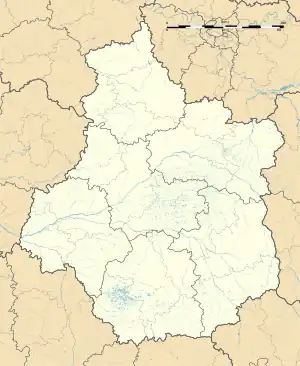 Chécy | |
| Coordinates: 47°53′39″N 2°01′39″E / 47.8942°N 2.0275°E | |
| Country | France |
| Region | Centre-Val de Loire |
| Department | Loiret |
| Arrondissement | Orléans |
| Canton | Saint-Jean-de-Braye |
| Intercommunality | Orléans Métropole |
| Government | |
| • Mayor (2020–2026) | Jean-Vincent Vallies[1] |
| Area 1 | 15.47 km2 (5.97 sq mi) |
| Population | 8,808 |
| • Density | 570/km2 (1,500/sq mi) |
| Demonym | Caciens |
| Time zone | UTC+01:00 (CET) |
| • Summer (DST) | UTC+02:00 (CEST) |
| INSEE/Postal code | 45089 /45430 |
| Elevation | 95–116 m (312–381 ft) |
| Website | www.checy.fr |
| 1 French Land Register data, which excludes lakes, ponds, glaciers > 1 km2 (0.386 sq mi or 247 acres) and river estuaries. | |
Chécy (French pronunciation: [ʃesi]) is a commune in the Loiret department in north-central France.
Population
| Year | Pop. | ±% p.a. |
|---|---|---|
| 1968 | 2,283 | — |
| 1975 | 3,986 | +8.29% |
| 1982 | 6,299 | +6.76% |
| 1990 | 7,177 | +1.64% |
| 1999 | 7,221 | +0.07% |
| 2007 | 7,953 | +1.21% |
| 2012 | 8,585 | +1.54% |
| 2017 | 8,667 | +0.19% |
| Source: INSEE[3] | ||
See also
References
- ↑ "Répertoire national des élus: les maires". data.gouv.fr, Plateforme ouverte des données publiques françaises (in French). 2 December 2020.
- ↑ "Populations légales 2021". The National Institute of Statistics and Economic Studies. 28 December 2023.
- ↑ Population en historique depuis 1968, INSEE
Wikimedia Commons has media related to Chécy.
This article is issued from Wikipedia. The text is licensed under Creative Commons - Attribution - Sharealike. Additional terms may apply for the media files.