Dawson, West Virginia | |
|---|---|
 Dawson  Dawson | |
| Coordinates: 37°51′22″N 80°42′39″W / 37.85611°N 80.71083°W | |
| Country | United States |
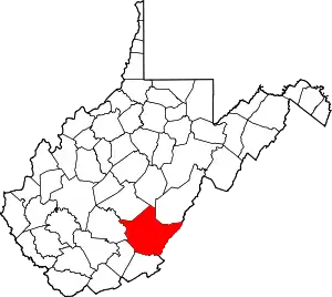
| State | West Virginia |
| County | Greenbrier |
| Elevation | 2,434 ft (742 m) |
| Time zone | UTC-5 (Eastern (EST)) |
| • Summer (DST) | UTC-4 (EDT) |
| Area code(s) | 304 & 681 |
| GNIS feature ID | 1558356[1] |
Dawson is an unincorporated community in Greenbrier County, West Virginia, United States. Dawson is located at Exit 150 of Interstate 64, 7.5 miles (12.1 km) east of Meadow Bridge.
References
- ↑ "US Board on Geographic Names". United States Geological Survey. October 25, 2007. Retrieved January 31, 2008.
This article is issued from Wikipedia. The text is licensed under Creative Commons - Attribution - Sharealike. Additional terms may apply for the media files.