East Dailey | |
|---|---|
Census-designated place (CDP) | |
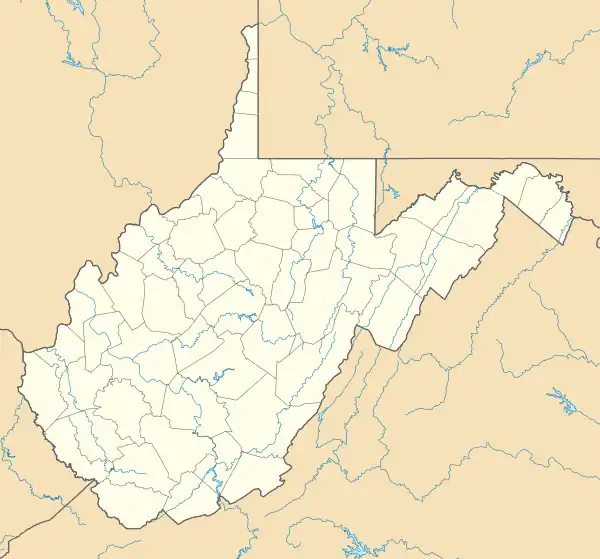 East Dailey Location within the state of West Virginia | |
| Coordinates: 38°46′49″N 79°53′27″W / 38.78028°N 79.89083°W | |
| Country | United States |
| State | West Virginia |
| County | Randolph |
| Area | |
| • Total | 1.051 sq mi (2.72 km2) |
| • Land | 1.051 sq mi (2.72 km2) |
| • Water | 0 sq mi (0 km2) |
| Elevation | 1,998 ft (609 m) |
| Population | |
| • Total | 557 |
| • Density | 530/sq mi (200/km2) |
| Time zone | UTC-5 (Eastern (EST)) |
| • Summer (DST) | UTC-4 (EDT) |
| GNIS feature ID | 1554350[2] |
East Dailey is a census-designated place (CDP) in Randolph County, West Virginia, United States. As of the 2010 census, its population was 557.[3] It is located within the Monongahela National Forest adjacent to the Tygart Valley River. East Dailey and its Old Timer's Camp are host to the Elkhenge Music Festival.
References
- ↑ "US Gazetteer files: 2010, 2000, and 1990". United States Census Bureau. February 12, 2011. Retrieved April 23, 2011.
- 1 2 U.S. Geological Survey Geographic Names Information System: East Dailey, West Virginia
- 1 2 "U.S. Census website". United States Census Bureau. Retrieved May 14, 2011.
External links
Municipalities and communities of Randolph County, West Virginia, United States | ||
|---|---|---|
| City | 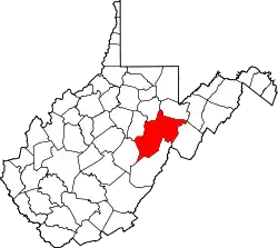 Map of West Virginia highlighting Randolph County | |
| Towns | ||
| CDPs | ||
| Other communities |
| |
| Ghost towns | ||
| Footnotes | ‡This populated place also has portions in an adjacent county or counties | |
This article is issued from Wikipedia. The text is licensed under Creative Commons - Attribution - Sharealike. Additional terms may apply for the media files.