Oberschützen | |
|---|---|
 View of Oberschützen | |
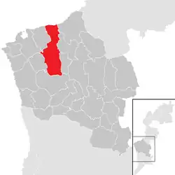 Location within Oberwart district | |
 Oberschützen Location within Austria | |
| Coordinates: 47°21′N 16°13′E / 47.350°N 16.217°E | |
| Country | Austria |
| State | Burgenland |
| District | Oberwart |
| Government | |
| • Mayor | Hans Unger |
| Area | |
| • Total | 44.39 km2 (17.14 sq mi) |
| Elevation | 355 m (1,165 ft) |
| Population (2018-01-01)[2] | |
| • Total | 2,429 |
| • Density | 55/km2 (140/sq mi) |
| Time zone | UTC+1 (CET) |
| • Summer (DST) | UTC+2 (CEST) |
| Postal code | 7432 |
| Website | www.oberschuetzen.at |
Oberschützen (Hungarian: Felsőlövő, Felső-Lövő derived from "Felső"=upper, "Lövő"=shooter) is a town in the district of Oberwart in the Austrian state of Burgenland.
Subdivisions
- Aschau im Burgenland
- Oberschützen
- Schmiedrait
- Unterschützen
- Willersdorf
Population
| Year | Pop. | ±% |
|---|---|---|
| 1869 | 3,134 | — |
| 1880 | 3,395 | +8.3% |
| 1890 | 3,464 | +2.0% |
| 1900 | 3,179 | −8.2% |
| 1910 | 3,096 | −2.6% |
| 1923 | 2,961 | −4.4% |
| 1934 | 3,185 | +7.6% |
| 1939 | 2,998 | −5.9% |
| 1951 | 2,577 | −14.0% |
| 1961 | 2,424 | −5.9% |
| 1971 | 2,414 | −0.4% |
| 1981 | 2,486 | +3.0% |
| 1991 | 2,411 | −3.0% |
| 2001 | 2,289 | −5.1% |
| 2011 | 2,358 | +3.0% |
See also
References
- ↑ "Dauersiedlungsraum der Gemeinden Politischen Bezirke und Bundesländer - Gebietsstand 1.1.2018". Statistics Austria. Retrieved 10 March 2019.
- ↑ "Einwohnerzahl 1.1.2018 nach Gemeinden mit Status, Gebietsstand 1.1.2018". Statistics Austria. Retrieved 9 March 2019.
This article is issued from Wikipedia. The text is licensed under Creative Commons - Attribution - Sharealike. Additional terms may apply for the media files.