Loipersdorf-Kitzladen | |
|---|---|
 Lutheran school and prayer house | |
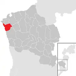 Location within Oberwart district | |
 Loipersdorf-Kitzladen Location within Austria | |
| Coordinates: 47°20′N 16°5′E / 47.333°N 16.083°E | |
| Country | Austria |
| State | Burgenland |
| District | Oberwart |
| Government | |
| • Mayor | Thomas Böhm |
| Area | |
| • Total | 15.88 km2 (6.13 sq mi) |
| Elevation | 368 m (1,207 ft) |
| Population (2018-01-01)[2] | |
| • Total | 1,319 |
| • Density | 83/km2 (220/sq mi) |
| Time zone | UTC+1 (CET) |
| • Summer (DST) | UTC+2 (CEST) |
| Postal code | 7411 |
| Website | www.loipersdorf-kitzladen.at |
Loipersdorf-Kitzladen is a town in the district of Oberwart in the Austrian state of Burgenland.
Population
| Year | Pop. | ±% |
|---|---|---|
| 1869 | 1,098 | — |
| 1880 | 1,156 | +5.3% |
| 1890 | 1,237 | +7.0% |
| 1900 | 1,289 | +4.2% |
| 1910 | 1,285 | −0.3% |
| 1923 | 1,235 | −3.9% |
| 1934 | 1,271 | +2.9% |
| 1939 | 1,247 | −1.9% |
| 1951 | 1,001 | −19.7% |
| 1961 | 1,046 | +4.5% |
| 1971 | 1,098 | +5.0% |
| 1981 | 1,165 | +6.1% |
| 1991 | 1,225 | +5.2% |
| 2001 | 1,260 | +2.9% |
| 2011 | 1,296 | +2.9% |
References
- ↑ "Dauersiedlungsraum der Gemeinden Politischen Bezirke und Bundesländer - Gebietsstand 1.1.2018". Statistics Austria. Retrieved 10 March 2019.
- ↑ "Einwohnerzahl 1.1.2018 nach Gemeinden mit Status, Gebietsstand 1.1.2018". Statistics Austria. Retrieved 9 March 2019.
This article is issued from Wikipedia. The text is licensed under Creative Commons - Attribution - Sharealike. Additional terms may apply for the media files.